Portal maintenance status: (No date set)
|
The World Portal


The world is the totality of entities, the whole of reality, or everything that is. The nature of the world has been conceptualized differently in different fields. Some conceptions see the world as unique while others talk of a "plurality of worlds". Some treat the world as one simple object while others analyze the world as a complex made up of parts. In scientific cosmology, the world or universe is commonly defined as "[t]he totality of all space and time; all that is, has been, and will be". Theories of modality talk of possible worlds as complete and consistent ways how things could have been. Phenomenology, starting from the horizon of co-given objects present in the periphery of every experience, defines the world as the biggest horizon or the "horizon of all horizons". In philosophy of mind, the world is contrasted with the mind as that which is represented by the mind. Theology conceptualizes the world in relation to God, for example, as God's creation, as identical to God or as the two being interdependent. In religions, there is a tendency to downgrade the material or sensory world in favor of a spiritual world to be sought through religious practice. A comprehensive representation of the world and our place in it, as is found in religions, is known as a worldview. Cosmogony is the field that studies the origin or creation of the world while eschatology refers to the science or doctrine of the last things or of the end of the world.
In various contexts, the term "world" takes a more restricted meaning associated, for example, with the Earth and all life on it, with humanity as a whole or with an international or intercontinental scope. In this sense, world history refers to the history of humanity as a whole and world politics is the discipline of political science studying issues that transcend nations and continents. Other examples include terms such as "world religion", "world language", "world government", "world war", "world population", "world economy" or "world championship". (Full article...)
Selected articles -
 Image 1World history or global history as a field of historical study examines history from a global perspective. It emerged centuries ago; leading practitioners have included Voltaire (1694–1778), Hegel (1770–1831), Karl Marx (1818–1883), Oswald Spengler (1880–1936), and Arnold J. Toynbee (1889–1975). The field became much more active (in terms of university teaching, text books, scholarly journals, and academic associations) in the late 20th century.
It is not to be confused with comparative history, which, like world history, deals with the history of multiple cultures and nations, but does not do so on a global scale. World history looks for common patterns that emerge across all cultures. World historians use a thematic approach, with two major focal points: integration (how processes of world history have drawn people of the world together) and difference (how patterns of world history reveal the diversity of the human experience). (Full article...) Image 2
 A world map on the Winkel tripel projection,
a low-error map projection adopted by the National Geographic Society for reference maps
A world map is a map of most or all of the surface of Earth. World maps, because of their scale, must deal with the problem of projection. Maps rendered in two dimensions by necessity distort the display of the three-dimensional surface of the Earth. While this is true of any map, these distortions reach extremes in a world map. Many techniques have been developed to present world maps that address diverse technical and aesthetic goals.
Charting a world map requires global knowledge of the Earth, its oceans, and its continents. From prehistory through the Middle ages, creating an accurate world map would have been impossible because less than half of Earth's coastlines and only a small fraction of its continental interiors were known to any culture. With exploration that began during the European Renaissance, knowledge of the Earth's surface accumulated rapidly, such that most of the world's coastlines had been mapped, at least roughly, by the mid-1700s and the continental interiors by the twentieth century. (Full article...) Image 3"We Are the World" is a charity single originally recorded by the supergroup USA for Africa in 1985. It was written by Michael Jackson and Lionel Richie and produced by Quincy Jones and Michael Omartian for the album We Are the World. With sales in excess of 20 million copies, it is the eighth-best-selling physical single of all time.
Soon after the UK-based group Band Aid released "Do They Know It's Christmas?" in December 1984, the musician and activist Harry Belafonte began to think about an American benefit single for African famine relief. He enlisted fundraiser Ken Kragen to help bring the vision to reality. The duo contacted several musicians, and enlisted Jackson and Richie to write the song; they completed the writing seven weeks after the release of "Do They Know It's Christmas?", and only one night before "We Are the World"'s first recording session, on January 21, 1985. The historic event brought together some of the era's best-known musicians. (Full article...) Image 4
 Temperature record of the last 2,000 years (Chart showing the so-called Medieval Warm Period and Little Ice Age were not planet-wide phenomena)
The global temperature record shows the fluctuations of the temperature of the atmosphere and the oceans through various spans of time. There are numerous estimates of temperatures since the end of the Pleistocene glaciation, particularly during the current Holocene epoch. Some temperature information is available through geologic evidence, going back millions of years. More recently, information from ice cores covers the period from 800,000 years before the present time until now. A study of the paleoclimate covers the time period from 12,000 years ago to the present. Tree rings and measurements from ice cores can give evidence about the global temperature from 1,000-2,000 years before the present until now. The most detailed information exists since 1850, when methodical thermometer-based records began. Modifications on the Stevenson-type screen were made for uniform instrument measurements around 1880. (Full article...) Image 5The international community is a term used in geopolitics and international relations to refer to a broad group of people and governments of the world. (Full article...)
 Image 6The political history of the world is the history of the various political entities created by the human race throughout their existence and the way these states define their borders. Throughout history, political systems have expanded from basic systems of self-governance and monarchy to the complex democratic and totalitarian systems that exist today. In parallel, political entities have expanded from vaguely defined frontier-type boundaries, to the national definite boundaries existing today. (Full article...)
 Image 7The list of climate change controversies (or list of global warming controversies) concerns past or present public debates over certain aspects of climate change: whether it is occurring (climate change deniers dispute this), how much has occurred in modern times, what has caused it (attribution of climate change), what its effects will be, whether action should be taken to curb it now or later, and so forth. In the scientific literature, there is a very strong consensus that global surface temperatures have increased in recent decades and that the trend is caused by human-induced emissions of greenhouse gases.
The controversies are, by now, mostly political rather than scientific: there is a scientific consensus that global warming is happening and is caused by human activity. Public debates that also reflect scientific debate include estimates of how responsive the climate system might be to any given level of greenhouse gases (climate sensitivity). Disputes over the key scientific facts of global warming are more prevalent in the media than in the scientific literature, where such issues are treated as resolved, and such disputes are more prevalent in the United States and Australia than globally. (Full article...)
General images -

 Image 2Trilobites first appeared during the Cambrian period and were among the most widespread and diverse groups of Paleozoic organisms. (from History of Earth)
.jpg.webp) Image 3First airplane, the Wright Flyer, flew on 17 December 1903.
Image 3First airplane, the Wright Flyer, flew on 17 December 1903. Image 4The replicator in virtually all known life is deoxyribonucleic acid. DNA is far more complex than the original replicator and its replication systems are highly elaborate. (from History of Earth)
 Image 6Earth's axial tilt causing different angles of seasonal illumination at different orbital positions around the Sun (from Earth)
 Image 8The pale orange dot, an artist's impression of the early Earth which might have appeared orange through its hazy methane rich prebiotic second atmosphere. Earth's atmosphere at this stage was somewhat comparable to today's atmosphere of Titan. (from History of Earth)
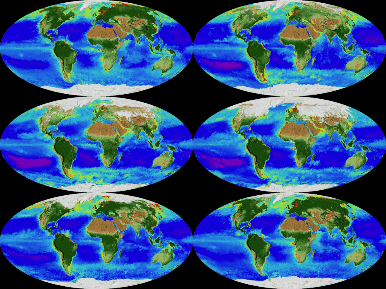 Image 9An animation of the changing density of productive vegetation on land (low in brown; heavy in dark green) and phytoplankton at the ocean surface (low in purple; high in yellow) (from Earth)
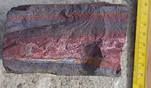 Image 11A banded iron formation from the 3.15 Ga Moodies Group, Barberton Greenstone Belt, South Africa. Red layers represent the times when oxygen was available; gray layers were formed in anoxic circumstances. (from History of Earth)
 Image 12Artist's impression of a Hadean landscape with the relatively newly formed Moon still looming closely over Earth and both bodies sustaining strong volcanism. (from History of Earth)
 Image 14Lithified stromatolites on the shores of Lake Thetis, Western Australia. Archean stromatolites are the first direct fossil traces of life on Earth. (from History of Earth)

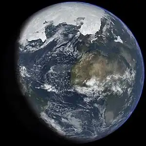 Image 17An artist's impression of ice age Earth at glacial maximum. (from History of Earth)
.jpg.webp) Image 18Vitruvian Man by Leonardo da Vinci epitomizes the advances in art and science seen during the Renaissance. (from History of Earth)
Image 18Vitruvian Man by Leonardo da Vinci epitomizes the advances in art and science seen during the Renaissance. (from History of Earth)
 Image 21A view of Earth with its global ocean and cloud cover, which dominate Earth's surface and hydrosphere; at Earth's polar regions, its hydrosphere forms larger areas of ice cover. (from Earth)
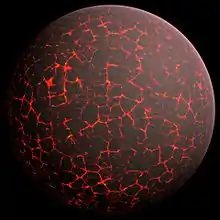 Image 22Artist's conception of Hadean Eon Earth, when it was much hotter and inhospitable to all forms of life. (from History of Earth)

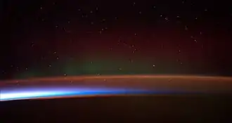 Image 25Earth's atmosphere as it appears from space, as bands of different colours at the horizon. From the bottom, afterglow illuminates the troposphere in orange with silhouettes of clouds, and the stratosphere in white and blue. Next the mesosphere (pink area) extends to just below the edge of space at one hundred kilometers and the pink line of airglow of the lower thermosphere (invisible), which hosts green and red aurorae over several hundred kilometers. (from Earth)
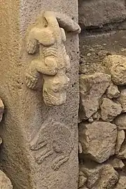 Image 26A pillar at Göbekli Tepe
 Image 28The Pantheon, originally a Roman temple, now a Catholic church
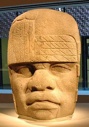 Image 29Olmec colossal head, now at the Museo de Antropología de Xalapa
 Image 30Earth's western hemisphere showing topography relative to Earth's center instead of to mean sea level, as in common topographic maps (from Earth)
 Image 31A reconstruction of human history based on fossil data. (from History of Earth)
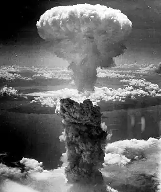 Image 32Atomic bombing of Nagasaki, 1945
.jpeg.webp) Image 33Standing Buddha from Gandhara, 2nd century CE
Image 33Standing Buddha from Gandhara, 2nd century CE

 Image 36A 580 million year old fossil of Spriggina floundensi, an animal from the Ediacaran period. Such life forms could have been ancestors to the many new forms that originated in the Cambrian Explosion. (from History of Earth)

 Image 39A view of Earth with different layers of its atmosphere visible: the troposphere with its clouds casting shadows, a band of stratospheric blue sky at the horizon, and a line of green airglow of the lower thermosphere around an altitude of 100 km, at the edge of space (from Earth)
 Image 40Empires of the world in 1898
 Image 41"Lucy", the first Australopithecus afarensis skeleton found. Lucy was only 1.06 m (3 ft 6 in) tall.
 Image 43Map of peopling of the world (Southern Dispersal paradigm), in thousands of years ago.
 Image 45Japanese depiction of a Portuguese carrack. European maritime innovations led to proto-globalization.
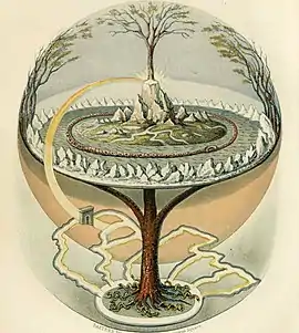 Image 46Yggdrasil, an attempt to reconstruct the Norse world tree which connects the heavens, the world, and the underworld. (from World)
 Image 47A 2012 artistic impression of the early Solar System's protoplanetary disk from which Earth and other Solar System bodies were formed (from Earth)
 Image 48A map of heat flow from Earth's interior to the surface of Earth's crust, mostly along the oceanic ridges (from Earth)
 Image 49Battle during 1281 Mongol invasion of Japan

 Image 52Tracy Caldwell Dyson, a NASA astronaut, observing Earth from the Cupola module at the International Space Station on 11 September 2010 (from Earth)
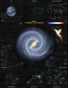
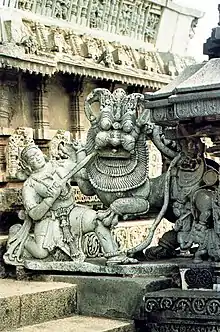
 Image 55Geologic map of North America, color-coded by age. From most recent to oldest, age is indicated by yellow, green, blue, and red. The reds and pinks indicate rock from the Archean.
 Image 56A computer-generated image mapping the prevalence of artificial satellites and space debris around Earth in geosynchronous and low Earth orbit (from Earth)
 Image 57Notre-Dame de Paris

 Image 60Graph showing range of estimated partial pressure of atmospheric oxygen through geologic time (from History of Earth)

 Image 63Dinosaurs were the dominant terrestrial vertebrates throughout most of the Mesozoic (from History of Earth)


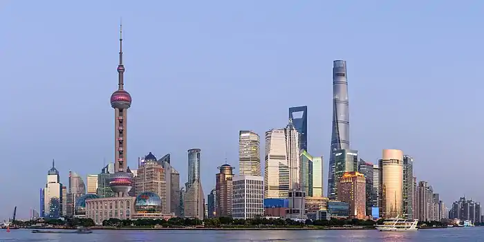 Image 68Shanghai. China urbanized rapidly in the 21st century.
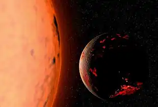
 Image 70Last Moon landing: Apollo 17 (1972)
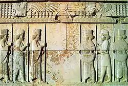
 Image 72An artist's impression of the Archean, the eon after Earth's formation, featuring round stromatolites, which are early oxygen-producing forms of life from billions of years ago. After the Late Heavy Bombardment, Earth's crust had cooled, its water-rich barren surface is marked by continents and volcanoes, with the Moon still orbiting Earth half as far as it is today, appearing 2.8 times larger and producing strong tides. (from Earth)
 Image 73Tiktaalik, a fish with limb-like fins and a predecessor of tetrapods. Reconstruction from fossils about 375 million years old. (from History of Earth)
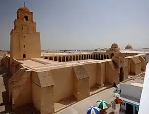 Image 74Great Mosque of Kairouan, Tunisia, founded 670 CE
 Image 75Artist's impression of Earth during the later Archean, the largely cooled planetary crust and water-rich barren surface, marked by volcanoes and continents, features already round microbialites. The Moon, still orbiting Earth much closer than today and still dominating Earth's sky, produced strong tides. (from History of Earth)
.svg.png.webp)
 Image 77Fall of the Berlin Wall, 1989
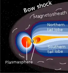 Image 78A schematic view of Earth's magnetosphere with solar wind flowing from left to right (from Earth)
 Image 79Change in average surface air temperature and drivers for that change. Human activity has caused increased temperatures, with natural forces adding some variability. (from Earth)
 Image 80Artist's rendition of an oxinated fully-frozen Snowball Earth with no remaining liquid surface water. (from History of Earth)
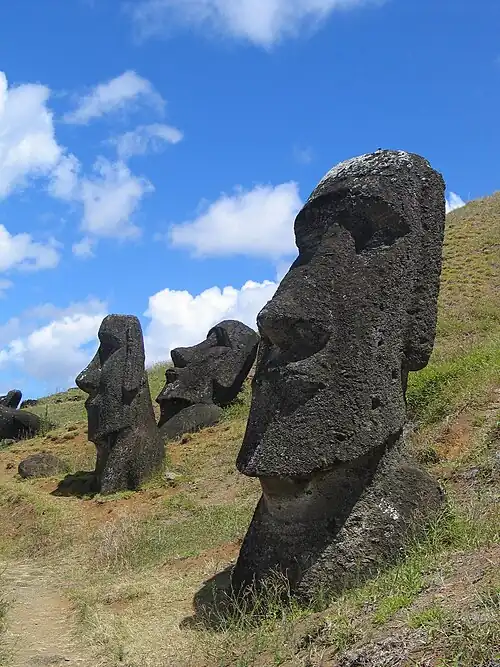
 Image 83Pangaea was a supercontinent that existed from about 300 to 180 Ma. The outlines of the modern continents and other landmasses are indicated on this map. (from History of Earth)
 Image 84Chloroplasts in the cells of a moss (from History of Earth)
 Image 85Astronaut Buzz Aldrin on the Moon, photographed by Neil Armstrong, 1969 (from History of Earth)
 Image 86A composite image of Earth, with its different types of surface discernible: Earth's surface dominating Ocean (blue), Africa with lush (green) to dry (brown) land and Earth's polar ice in the form of Antarctic sea ice (grey) covering the Antarctic or Southern Ocean and the Antarctic ice sheet (white) covering Antarctica. (from Earth)
.jpg.webp)
 Image 88Earth's land use for human agriculture (from Earth)
 Image 89Pale orange dot, an artist's impression of Early Earth, featuring its tinted orange methane-rich early atmosphere (from Earth)
 Image 91Artist's impression of the enormous collision that probably formed the Moon (from History of Earth)
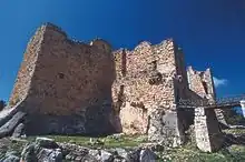 Image 92Ajloun Castle, Jordan
Megacities of the world -

Tianjin is a municipality and a coastal metropolis in Northern China on the shore of the Bohai Sea. As such, it is not part of a province of China. It is one of the nine national central cities in Mainland China, with a total population of 13,866,009 inhabitants during the 2020 Chinese census. Its built-up (or metro) area, made up of 12 central districts (all but Baodi, Jizhou, Jinghai and Ninghe), was home to 11,165,706 inhabitants and is also the world's 29th-largest agglomeration (between Chengdu and Rio de Janeiro) and 11th-most populous city proper.
It is governed as one of the four municipalities (alongside Beijing, Shanghai, and Chongqing) under the direct administration of the Chinese central government and is thus under direct administration of the State Council. Tianjin borders Hebei Province and Beijing Municipality, bounded to the east by the Bohai Gulf portion of the Yellow Sea. Part of the Bohai Economic Rim, it is the largest coastal city in Northern China and part of the Jing-Jin-Ji megapolis. (Full article...)Did you know -
- ... that King Hussein of Jordan gifted an ancient Roman column to New York City for the 1964–65 World's Fair?
- ... that although the April 1923 Kamchatka earthquake had a surface-wave magnitude of 6.8 to 7.3, its tsunami was larger than that of the magnitude-8.4 earthquake in February in the same region?
- ... that Brijmohan Lall Munjal grew Hero Cycles from a parts manufacturer into the world's largest bicycle company?
- ... that the play-by-email game Lords of the Earth takes about 25 years to play?
- ... that postcards were made of Olena Stepaniv during the First World War, and in 1991 Lviv named a street after her?
- ... that while Marvel Comics originally designated the main reality depicted in the MCU multiverse as Earth-199999, Doctor Strange in the Multiverse of Madness established it as Earth-616?
- ... that Mark Robinson was a world champion in submission wrestling, sumo and powerlifting?
- ... that magma travelling through dykes usually solidifies before it gets to the Earth's surface?
Countries of the world -
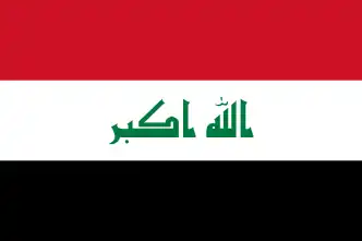
Iraq, officially the Republic of Iraq, is an Arab country in West Asia and in the geopolitical region known as the Middle East. With a population of over 46 million, it is the 14th-most populous country on the Asian continent and the 33rd-most populous country in the world. It is a federal parliamentary republic that consists of 19 governorates. The country is bordered by Turkey to the north, Iran to the east, the Persian Gulf and Kuwait to the southeast, Saudi Arabia to the south, Jordan to the southwest, and Syria to the west. The capital and largest city is Baghdad. The Iraqi people are diverse, with similarly diverse geography and wildlife. Most Iraqis are Muslims – minority faiths include Christianity, Yazidism, Mandaeism, Yarsanism, and Zoroastrianism. The official languages of Iraq are Arabic and Kurdish; others also recognized in specific regions are Turkish (Turkmen), Suret (Assyrian), and Armenian.
Starting as early as the 6th millennium BC, the fertile alluvial plains between Iraq's Tigris and Euphrates Rivers, referred to as Mesopotamia, gave rise to some of the world's earliest cities, civilizations, and empires in Sumer, Akkad, and Assyria. Mesopotamia was a "Cradle of Civilisation" that saw the inventions of a writing system, mathematics, timekeeping, a calendar, astrology, and a law code. Following the Muslim conquest of Mesopotamia, Baghdad became the capital and the largest city of the Abbasid Caliphate, and during the Islamic Golden Age, the city evolved into a significant cultural and intellectual center, and garnered a worldwide reputation for its academic institutions, including the House of Wisdom. The city was largely destroyed at the hands of the Mongol Empire in 1258 during the siege of Baghdad, resulting in a decline that would linger through many centuries due to frequent plagues and multiple successive empires. (Full article...)Related portals
Protected areas of the world -
 Image 1
There are currently 182 Protected Natural Areas in Mexico, covering 25.4 million hectares in total. They are protected and administered by the National Commission of Protected Natural Areas (Comisión Nacional de Áreas Naturales Protegidas, or 'CONANP'), a federal agency. CONANP administers:- 67 Mexican National Parks
- 44 biosphere reserves
- 40 flora and fauna protection areas
- 18 Mexican Nature Sanctuaries
- 9 natural resources protection areas
- 11 natural monuments
 Image 2
 Vegetation outside Goz Beïda
The wildlife of Chad is composed of its flora and fauna. Bush elephants, West African lions, buffalo, hippopotamuses, Kordofan giraffes, antelopes, African leopards, cheetahs, hyenas, and many species of snakes are found there, although most large carnivore populations have been drastically reduced since the early 20th century. Elephant poaching, particularly in the south of the country in areas such as Zakouma National Park, is a severe problem. (Full article...) Image 3
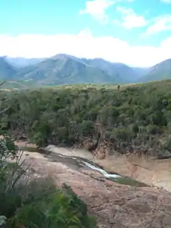 Andohahela National Park in southern Madagascar
The national parks of Madagascar include all officially recognized protected areas as of 2015. The protected areas network of Madagascar is managed by the Madagascar National Parks Association (PNM-ANGAP). The network includes three types of protected areas: Strict Nature Reserves (IUCN category Ia), National Parks (IUCN category II) and Wildlife Reserves (IUCN category IV). At the 2003 IUCN World Parks Congress in Durban, the Malagasy President, Marc Ravalomanana, announced an initiative to more than triple the area under protection from approximately 4,200,791 acres (17,000.00 km2) to over 14,826,322 acres (60,000.00 km2) (from 3% to 10% of Madagascar's area). This "Durban Vision", as it has been dubbed, involved broadening the definition of protected areas in the country and legislation has been passed to allow the creation of four new categories of protected area: Natural Parks (IUCN category II), Natural Monuments (IUCN category III), Protected Landscapes (IUCN category V), and Natural Resource Reserves (IUCN category VI). As well as allowing these new objectives for protected areas management, the new legislation also provided for entities other than PNM-ANGAP to manage protected areas, such as government ministries, community associations, NGOs and other civil society organizations, and the private sector. (Full article...) Image 4Kentucky's system of 44 state parks has been referred to as "the nation's finest" and experiences more repeat business annually than those of any other U.S. state. The state's diverse geography provides a variety of environments to experience. From mountain lakes to expansive caves to forests teeming with wildlife, park-goers have their choice of attractions, and they are all within a day's drive of each other.
Unless otherwise specified, data in the following lists are taken from Kentucky State Parks by Bill Bailey. (Full article...) Image 5The National Parks of Argentina make up a network of 35 national parks in Argentina. The parks cover a very varied set of terrains and biotopes, from Baritú National Park on the northern border with Bolivia to Tierra del Fuego National Park in the far south of the continent. The Administración de Parques Nacionales (National Parks Administration) is the agency that preserves and manages these national parks along with Natural monuments and National Reserves within the country.
The headquarters of the National Parks Service are in downtown Buenos Aires, on Santa Fe Avenue. A library and information centre are open to the public. The administration also covers the national monuments, such as the Jaramillo Petrified Forest, and natural and educational reserves. (Full article...) Image 6Forests in the state of Himachal Pradesh (northern India) currently cover an area of nearly 37,939 square kilometres (14,648 sq mi), which is about 68.16% of the total land area of the state. The forests were once considered to be the main source of income of the state and most of the original forests were clear felled. The emphasis has shifted, however, from exploitation to conservation. The state government aims to increase forest cover to 50% of the total land area. There have been various projects, including the establishment of protected areas such as National Parks, designed to preserve and expand the forests. (Full article...)
 Image 7This list of protected areas of Myanmar includes national parks, wildlife sanctuaries and botanical gardens that were established since 1927. (Full article...)
 Image 8
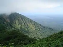 Mombacho Volcano Natural Reserve
The protected areas of Nicaragua are areas that have natural beauty or significance and are protected by Nicaragua. Nicaragua has 78 protected areas that cover 22,422 km2, about 17.3% of the nations landmass. The National System of Protected Areas (SINAP) is administered by the Ministry of the Environment and Natural Resources (MARENA). (Full article...) Image 9This is a list of protected areas of Sierra Leone, including national parks, game reserves, conservation areas, wetlands, and those that are listed as proposed protected areas in the UN Environment Programme World Conservation Monitoring Centre (UNEP WCM) database. (Full article...)
 Image 10
This is a list of protected areas in Armenia that are categorized as follows: 4 national parks, 3 state reserves, 27 state sanctuaries and 5 botanical gardens. (Full article...) Image 11
 The northernmost tip of Prins Karls Forland in Forlandet National Park
Svalbard is an Arctic wilderness archipelago comprising the northernmost part of Norway. There are twenty-nine protected natural areas, consisting of seven national parks, six nature reserves, fifteen bird sanctuaries and one geotope protected area. In addition, human traces dating from before 1946 are automatically protected. The protected areas make up 39,800 square kilometers (15,400 sq mi) or 65% of the land area, and 78,000 square kilometers (30,000 sq mi) or 86.5% of the territorial waters. The largest protected areas are Nordaust-Svalbard Nature Reserve and Søraust-Svalbard Nature Reserve, which cover most of the areas east of the main island of Spitsbergen, including the islands of Nordaustlandet, Edgeøya, Barentsøya, Kong Karls Land and Kvitøya. Six of the national parks are located on Spitsbergen. Ten of the bird sanctuaries and the Moffen Nature Reserve are located within national parks. Five of the bird sanctuaries are Ramsar sites and fourteen of the bird sanctuaries are islands. Svalbard is on Norway's tentative list for nomination as a UNESCO World Heritage Site.
The supreme responsibility for conservation lies with the Norwegian Ministry of the Environment, which has delegated the management to the Governor of Svalbard and the Norwegian Directorate for Nature Management. The foundation for conservation was established in the Svalbard Treaty of 1920, and has been further specified in the Svalbard Environmental Act of 2001. The first round of protection took force on 1 July 1973, when most of the current protected areas came into effect. This included the two large nature reserves and three of the national parks. Moffen Nature Reserve was established in 1983, followed by four national parks, three nature reserves and one geotope protection area between 2002 and 2005. (Full article...) Image 12
This list of protected areas of Quebec includes federally, provincially and municipally administered parks and wildlife reserves in Quebec, the largest province in Canada. (Full article...) Image 13
 Image 14
 Image 15
Protected areas in Tanzania (Hifahdi za Mali hai za Tanzania, in Swahili) are extremely varied, ranging from sea habitats over grasslands to the top of the Kilimanjaro, the tallest mountain in Africa. About a third of the country's total area is protected to a certain degree as a national park, game reserve, marine park, forest reserve or the like. 840 protected areas are spread across 7,330 km2 of ocean and 361,594 km2 of land in Tanzania. The coastal and marine areas are less protected than terrestrial ecosystems, which are given the highest level of protection. Tanzania is one of the world's major biodiversity hotspots thanks to its vast national parks, "the Eastern Arc" mountains, wetlands, coastal forests, marine, and freshwater systems as remarkable reservoirs of plant and animal species. A wide range of endemic species of birds, reptiles, snakes, amphibians, wild coffee variations, and the well-known African violet flower can also be found in Tanzania. (Full article...)
Selected world maps
 Image 1A plate tectonics map with volcano locations indicated with red circles
 Image 2Only a few of the largest large igneous provinces appear (coloured dark purple) on this geological map, which depicts crustal geologic provinces as seen in seismic refraction data
 Image 31516 map of the world by Martin Waldseemüller
 Image 4Time zones of the world
 Image 5United Nations Human Development Index map by country (2016)
 Image 6Index map from the International Map of the World (1:1,000,000 scale)
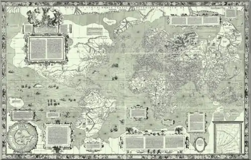 Image 7The world map by Gerardus Mercator (1569), the first map in the well-known Mercator projection
 Image 8The Goode homolosine projection is a pseudocylindrical, equal-area, composite map projection used for world maps.
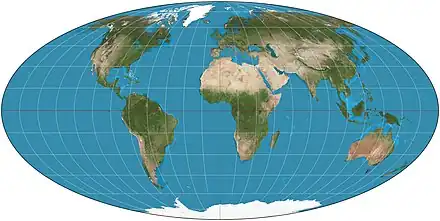 Image 9Mollweide projection of the world
World records
- List of Olympic records in athletics
- List of world records in athletics
- List of junior world records in athletics
- List of world records in masters athletics
- List of world youth bests in athletics
- List of IPC world records in athletics
- List of world records in canoeing
- List of world records in chess
- List of cycling records
- List of world records in track cycling
- List of world records in finswimming
- List of world records in juggling
- List of world records in rowing
- List of world records in speed skating
- List of world records in swimming
- List of IPC world records in swimming
- List of world records in Olympic weightlifting
Topics
Continents of Earth | ||||||||
|---|---|---|---|---|---|---|---|---|
| ||||||||
| ||||||||
| ||||||||
| Cenozoic Era (present–66.0 Ma) |
| ||||||||||||
|---|---|---|---|---|---|---|---|---|---|---|---|---|---|
| Mesozoic Era (66.0–252 Ma) |
| ||||||||||||
| Paleozoic Era (252–539 Ma) |
| ||||||||||||
| Proterozoic Eon (539 Ma–2.5 Ga) |
| ||||||||||||
| Archean Eon (2.5–4 Ga) | |||||||||||||
| Hadean Eon (4–4.6 Ga) | |||||||||||||
ka = kiloannum (thousands years ago); Ma = megaannum (millions years ago); Ga = gigaannum (billions years ago). See also: Geologic time scale • | |||||||||||||
| City proper | |
|---|---|
| Metropolitan area | |
| Urban area/agglomeration | |
| Historical | |
| Related articles | |
| Locations |  | |
|---|---|---|
| Related | ||
| Retrospectively recognized expositions | |||||||||||||
|---|---|---|---|---|---|---|---|---|---|---|---|---|---|
| BIE-recognized Universal expositions | |||||||||||||
| BIE-recognized specialized expositions |
| ||||||||||||
| BIE-recognized horticultural exhibitions (AIPH) | |||||||||||||
| Not BIE- recognized |
| ||||||||||||
†Postponed to 2021 due to the COVID-19 pandemic | |||||||||||||
| Confederations | |
|---|---|
| World Championships | |
| World Cup | |
| Special events | |
| Presidents |
|
| Awards |
|
| |||||||||||||||||||||
| |||||||||||||||||||||
| |||||||||||||||||||||
Economic classification of countries | |||||
|---|---|---|---|---|---|
| Three-World Model | |||||
| Gross domestic product (GDP) |
| ||||
| Gross national income (GNI) | |||||
| Wages | |||||
| Wealth | |||||
| Other national accounts | |||||
| Human development | |||||
| Digital divide | |||||
| Net international investment position (NIIP) | |||||
| Technological |
| ||||
|---|---|---|---|---|---|
| Sociological | |||||
| Ecological |
| ||||
| Biological |
| ||||
| Astronomical | |||||
| Eschatological |
| ||||
| Others |
| ||||
| Fictional | |||||
| Organizations | |||||
| |||||
| Theatres |
| ||||||||||||||||||
|---|---|---|---|---|---|---|---|---|---|---|---|---|---|---|---|---|---|---|---|
Principal participants |
| ||||||||||||||||||
| Timeline |
| ||||||||||||||||||
| Aspects |
| ||||||||||||||||||
| |||||||||||||||||||
| General |
| ||||||||||||||||
|---|---|---|---|---|---|---|---|---|---|---|---|---|---|---|---|---|---|
| Participants |
| ||||||||||||||||
| Timeline |
| ||||||||||||||||
| |||||||||||||||||
Categories
Wikimedia
The following Wikimedia Foundation sister projects provide more on this subject:
-
 Commons
Free media repository -
 Wikibooks
Free textbooks and manuals -
 Wikidata
Free knowledge base -
 Wikinews
Free-content news -
 Wikiquote
Collection of quotations -
 Wikisource
Free-content library -
 Wikispecies
Directory of species -
 Wikiversity
Free learning tools -
 Wikivoyage
Free travel guide -
 Wiktionary
Dictionary and thesaurus
More portals
-
 List of all portals
 -

-

-

-
-

-

-

-

-

-
 Random portal
 -
 WikiProject Portals


.svg.png.webp)
.svg.png.webp)
.svg.png.webp)
.svg.png.webp)


.svg.png.webp)
_political.svg.png.webp)
.svg.png.webp)
.svg.png.webp)
.svg.png.webp)
