Kunratice | |
|---|---|
%252C_kostel_(2).jpg.webp) Church of All Saints | |
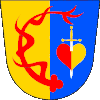
 Flag  Coat of arms | |
 Kunratice Location in the Czech Republic | |
| Coordinates: 50°55′17″N 15°1′34″E / 50.92139°N 15.02611°E | |
| Country | |
| Region | Liberec |
| District | Liberec |
| First mentioned | 1377 |
| Area | |
| • Total | 12.42 km2 (4.80 sq mi) |
| Elevation | 285 m (935 ft) |
| Population (2023-01-01)[1] | |
| • Total | 356 |
| • Density | 29/km2 (74/sq mi) |
| Time zone | UTC+1 (CET) |
| • Summer (DST) | UTC+2 (CEST) |
| Postal code | 464 01 |
| Website | www |
Kunratice (German: Kunnersdorf) is a municipality and village in Liberec District in the Liberec Region of the Czech Republic. It has about 400 inhabitants.
Geography
Kunratice is located about 16 km (10 mi) north of Liberec, in a salient region of Frýdlant Hook on the border with Poland. It lies in the Frýdlant Hills. The highest point is a hill at 382 m (1,253 ft) above sea level. The municipality is situated on the left bank of the Smědá River, which flows along the northeastern municipal border.
History
The first settlers came to the area at the turn of the 12th and 13th centuries. The first written mention of Kunratice is from 1377.[2]
Transport
There is a road border crossing Kunratice / Bogatynia with Poland.
Sights
The main landmark of Kunratice is the Church of All Saints. The originally Gothic church was first documented in 1376. It was completely rebuilt in the Baroque style in the 18th century, but several original elements have been preserved.[3]
Twin towns – sister cities
 Pieńsk, Poland
References
- ↑ "Population of Municipalities – 1 January 2023". Czech Statistical Office. 2023-05-23.
- ↑ "O obci" (in Czech). Obec Kunratice. Retrieved 2022-10-20.
- ↑ "Kostel Všech svatých" (in Czech). National Heritage Institute. Retrieved 2022-10-20.
- ↑ "Partnerství a spolupráce" (in Czech). Obec Kunratice. Retrieved 2022-10-20.