Chotyně | |
|---|---|
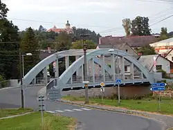
 Bridge over the Lusatian Neisse | |
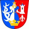
 Flag  Coat of arms | |
 Chotyně Location in the Czech Republic | |
| Coordinates: 50°50′11″N 14°52′9″E / 50.83639°N 14.86917°E | |
| Country | |
| Region | Liberec |
| District | Liberec |
| First mentioned | 1409 |
| Area | |
| • Total | 9.04 km2 (3.49 sq mi) |
| Elevation | 260 m (850 ft) |
| Population (2023-01-01)[1] | |
| • Total | 1,051 |
| • Density | 120/km2 (300/sq mi) |
| Time zone | UTC+1 (CET) |
| • Summer (DST) | UTC+2 (CEST) |
| Postal code | 463 34 |
| Website | www |
Chotyně (German: Ketten) is a municipality and village in Liberec District in the Liberec Region of the Czech Republic. It has about 1,100 inhabitants. It is known for the Grabštejn Castle.
Administrative parts
The village of Grabštejn is an administrative part of Chotyně.
Geography
Chotyně is located about 14 km (8.7 mi) northwest of Liberec. It lies in the Zittau Basin. The highest point is at 395 m (1,296 ft) above sea level. The Lusatian Neisse River flows through the municipality.
History
The first written mention of Chotyně is from 1409.[2]
Transport
The I/35 road from Liberec to the Czech-German border passes through the municipality.
Chotyně is located on a railway line heading from Liberec to Zittau and continuing to Varnsdorf.
Sights

The main landmark is the Grabštejn Castle. It was originally a Gothic castle, rebuilt in the Renaissance style. It belongs among the most important monuments in the region and is protected as a national cultural monument.[3] Today the castle is owned by the state and offers guided tours.[4]
References
- ↑ "Population of Municipalities – 1 January 2023". Czech Statistical Office. 2023-05-23.
- ↑ "Historie" (in Czech). Obec Chotyně. Retrieved 2023-08-15.
- ↑ "Hrad a zámek Grabštejn" (in Czech). National Heritage Institute. Retrieved 2023-08-15.
- ↑ "Tours". Grabštejn Castle (in Czech). National Heritage Institute. Retrieved 2023-08-15.