| Kuching Wetlands National Park | |
|---|---|
| Taman Negara Tanah Lembap Kuching | |
 View of the beach and pine habitat towards Mt. Santubong | |
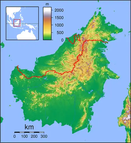
 Kuching NP Location in Borneo | |
| Location | Sarawak, Malaysia |
| Nearest city | Kuching |
| Coordinates | 1°41′N 110°15′E / 1.683°N 110.250°E |
| Area | 84.95 km2 (32.80 sq mi) |
| Established | 1992 |
| Governing body | Sarawak Forestry |
| Designated | 8 November 2005 |
| Reference no. | 1568[2] |
The Kuching Wetlands National Park (KWNP; Malay: Taman Negara Tanah Lembap Kuching) is a national park in Petra Jaya, Kuching District, Kuching Division, Sarawak, Malaysia. It is the remains of the former Sarawak Mangrove Forest Reserve which covered 170 km2.
Located 30 km from Kuching, the Wetlands National Park was gazetted in 1992 and covers an area of 66.1 km2 on the estuarine reaches of the Sibu Laut and Salak rivers. The park is composed of coastal, marine and freshwater ecosystems. The predominantly saline and deltaic mangrove system includes an extensive network of marine waterways and tidal creeks, formed by the interconnecting rivers of Sungei Sibu-Laut, Batang Salak and Sungei Santubong that form the boundary of the park. Some small patches of heath forest are found within the park.
Biodiversity
The park is the home of at least three predominantly arboreal primates; the endangered proboscis monkey (Nasalis larvatus), the long-tailed macaques and the silvered langurs. White-bellied sea eagles, mudskippers and horseshoe crabs are also present. Otters and the Irrawaddy dolphins can also be sighted. On nearby Mount Santubong, hornbills can be seen.
Historical interest
In the 12th century, the area was an important trading post between the interior peoples for their jungle produce predominantly animal parts valuable in Chinese medicine traded with the Chinese for their pottery and earthenwares. Past and existing excavations have unearthed remains of the former Iron smelting industries active hundreds of years past. The Impressive Mt. Santubong acted as a clear navigational point for these traders no doubt.
Future
Many jobs depend upon this habitat for the rich abundance of fish that are spawned and grow amongst the protection of the root systems. Timber is extracted for construction and several charcoal factories. The tourism industry is starting to grow offering wildlife cruises. The heavy decline in the proboscis monkey population caused by hunting, was largely arrested by the educational efforts of the Sarawak Forestry department protecting and banning the trade of these animals.
Mangroves serve as important coastal defences absorbing strong waves and reputably up to 95% of the waves energy in extreme cases, such as a tsunami or king tide limiting damage. This attribute alone should be cause to justify their existence.
Extensive development predominantly housing but including quarrying and retail premises is occurring outside the parks boundary. These habitats are used by the many animals found in the park, thus increasing the pressure on this small reserve. As future development increases surrounding the park the existing gene pool will have to suffice since breeding between animals outside the park will no longer be possible.
Conservation
One suggestion is to: Protect a corridor/strip of land from development for the purpose of migration and breeding of animal species between other nearby habitats. Implementation would be possible with government intervention since existing routes are still currently feasible i.e. some undeveloped tracts still exist.
Kuching wetlands N. P. is only about 20 km from Bako National Park which is well catered for receiving visitors.
See also
References
- ↑ UNEP-WCMC (2023). Protected Area Profile for Kuching Wetland National Park from the World Database on Protected Areas. Accessed 18 March 2023.
- ↑ "Kuching Wetlands National Park". Ramsar Sites Information Service. Retrieved 25 April 2018.
- Beavitt, W. & Tuen.A.A (2010). Swamp - Kuching Wetlands National Park. UNIMAS: Kuching. pp. 112. Sarawak, Malaysia, Borneo, William Beavitt & Dr Andrew Alek Tuen.