Union Gap, Oregon | |
|---|---|
 Union Gap, Oregon  Union Gap, Oregon | |
| Coordinates: 43°26′36″N 123°33′04″W / 43.4434489°N 123.5512015°W | |
| Country | United States |
| State | Oregon |
| County | Douglas |
| Elevation | 200 ft (61 m) |
| Time zone | UTC-8 (Pacific (PST)) |
| • Summer (DST) | UTC-7 (PDT) |
| ZIP code | 97462 |
| Area code(s) | 458 and 541 |
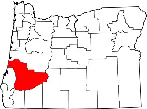
Union Gap is an unincorporated community located in Douglas County, Oregon.[1]
References
- ↑ "GNIS Detail - Union Gap". Retrieved June 21, 2016.
This article is issued from Wikipedia. The text is licensed under Creative Commons - Attribution - Sharealike. Additional terms may apply for the media files.
