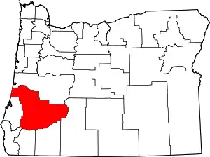
Shady is an unincorporated community in Douglas County, Oregon, United States.[1] It is about two miles south of Roseburg on a stretch of Oregon Route 99 also known as the Oakland-Shady Highway.[2] Shady is outside Roseburg's urban growth boundary, but it does have sewer service.[3] Because of sewer availability, Douglas County considers Shady an "urban unincorporated area".[3][4] It is next to the South Umpqua River.[2]
Like nearby Green, Shady was a station on the Siskiyou Line of the Southern Pacific Railroad.[5] A cliff in the area is named "Shady Point".[6]
References
- ↑ "Shady". Geographic Names Information System. United States Geological Survey, United States Department of the Interior. November 28, 1980. Retrieved December 16, 2010.
- 1 2 Oregon Atlas & Gazetteer (7th ed.). Yarmouth, Maine: DeLorme. 2008. p. 53. ISBN 0-89933-347-8.
- 1 2 "Douglas County Transportation System Plan" (PDF). November 1998. p. 218. Retrieved December 16, 2010.
- ↑ "Agenda". Douglas County Board of Commissioners. November 23, 2005. Retrieved December 16, 2010.
- ↑ Harrison, Ken (October 1, 1994). "Southern Pacific Station Names". Retrieved December 16, 2010.
- ↑ "Shady Point". Geographic Names Information System. United States Geological Survey, United States Department of the Interior. May 1, 1994. Retrieved December 16, 2010.
External links
- January 30, 1897 New York Times story about a train robbery at Shady Point
43°10′29″N 123°21′37″W / 43.174838°N 123.360349°W
This article is issued from Wikipedia. The text is licensed under Creative Commons - Attribution - Sharealike. Additional terms may apply for the media files.
