| Ramal de Cáceres | |
|---|---|
 Ramal de Cáceres near to Castelo de Vide railway station. | |
| Overview | |
| Status | Closed |
| Owner | Infraestruturas de Portugal |
| Termini |
|
| Technical | |
| Line length | 72.4 km (45.0 mi) |
| Track gauge | Iberian |
| Location on the network |
 + Torre V. × M.-B. (🔎) |
Ramal de Cáceres | |||||||||||||||||||||||||||||||||||||||||||||||||||||||||||||||||||||||||||||||||||||||||||||||||||||||||||
|---|---|---|---|---|---|---|---|---|---|---|---|---|---|---|---|---|---|---|---|---|---|---|---|---|---|---|---|---|---|---|---|---|---|---|---|---|---|---|---|---|---|---|---|---|---|---|---|---|---|---|---|---|---|---|---|---|---|---|---|---|---|---|---|---|---|---|---|---|---|---|---|---|---|---|---|---|---|---|---|---|---|---|---|---|---|---|---|---|---|---|---|---|---|---|---|---|---|---|---|---|---|---|---|---|---|---|---|
| |||||||||||||||||||||||||||||||||||||||||||||||||||||||||||||||||||||||||||||||||||||||||||||||||||||||||||
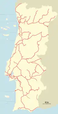
Ramal de Cáceres is a closed Portuguese railway line which connected Torre das Vargens railway station, on the Linha do Leste, and Marvão-Beirã railway station, near to the border with Spain. It was completed on 15 October 1879, but was only opened on 6 June 1880.[1] From 1881, the line was used as a faster alternative for international travelers between Portugal and Spain compared to the Linha do Leste, due to a better connection to the Spanish network.[2] It was closed by REFER on 15 August 2012.[3]
See also
References
- ↑ Torres, Carlos Manitto (1 February 1958). "A evolução das linhas portuguesas e o seu significado ferroviário" (PDF). Gazeta dos Caminhos de Ferro (in Portuguese). Retrieved 22 December 2018.
- ↑ SOUSA, José Fernando de (16 April 1905). "Ligações com a rêde espanhola" (PDF). Gazeta dos Caminhos de Ferro. Vol. 18, no. 416. p. 3. Retrieved 16 January 2017.
- ↑ "Protestos contra encerramento do ramal de Cáceres". Correio da Manhã (in Portuguese). 14 August 2012. Retrieved 15 January 2018.
This article is issued from Wikipedia. The text is licensed under Creative Commons - Attribution - Sharealike. Additional terms may apply for the media files.