Polná na Šumavě | |
|---|---|
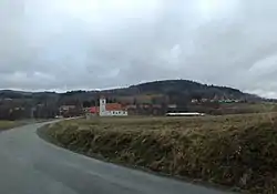
 View from the south | |
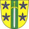
 Flag  Coat of arms | |
 Polná na Šumavě Location in the Czech Republic | |
| Coordinates: 48°47′57″N 14°8′49″E / 48.79917°N 14.14694°E | |
| Country | |
| Region | South Bohemian |
| District | Český Krumlov |
| First mentioned | 1259 |
| Area | |
| • Total | 19.12 km2 (7.38 sq mi) |
| Elevation | 750 m (2,460 ft) |
| Population (2023-01-01)[1] | |
| • Total | 199 |
| • Density | 10/km2 (27/sq mi) |
| Time zone | UTC+1 (CET) |
| • Summer (DST) | UTC+2 (CEST) |
| Postal code | 382 29 |
| Website | www |
Polná na Šumavě (German: Stein im Böhmerwald) is a municipality and village in Český Krumlov District in the South Bohemian Region of the Czech Republic. It has about 200 inhabitants.
Administrative parts
Villages and hamlets of Květušín, Olšina and Otice are administrative parts of Polná na Šumavě.
History
The first written mention of Polná na Šumavě is from 1259.[2] The municipality was recreated on 1 January 2016 by diminishing of Boletice Military Training Area.[3]
References
- ↑ "Population of Municipalities – 1 January 2023". Czech Statistical Office. 2023-05-23.
- ↑ Profous, Antonín (1951). Místní jména v Čechách III: M–Ř (in Czech). p. 429.
- ↑ "Nejnovější obce slaví dva roky existence. Polná na Šumavě se naučila fungovat, domy lidem zatím neprodá" (in Czech). Czech Television. 2017-12-25. Retrieved 2022-07-08.
External links
Wikimedia Commons has media related to Polná na Šumavě.
This article is issued from Wikipedia. The text is licensed under Creative Commons - Attribution - Sharealike. Additional terms may apply for the media files.