Pogonik | |
|---|---|
 | |
 Pogonik Location in Slovenia | |
| Coordinates: 46°5′4.32″N 14°49′29.24″E / 46.0845333°N 14.8247889°E | |
| Country | |
| Traditional region | Lower Carniola |
| Statistical region | Central Sava |
| Municipality | Litija |
| Area | |
| • Total | 1.2 km2 (0.5 sq mi) |
| Elevation | 268.6 m (881.2 ft) |
| Population (2002) | |
| • Total | 16 |
| [1] | |
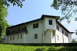
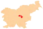
Pogonik (pronounced [pɔɡɔˈniːk]; sometimes Poganek,[2] German: Poganegg[3]) is a settlement on the right bank of the Sava River north of Litija in central Slovenia. The railway line from Ljubljana to Zidani Most runs through the settlement. The area is part of the traditional region of Lower Carniola. It is now included with the rest of the municipality in the Central Sava Statistical Region.[4]
History
Pogonik Castle was built in the early 16th century, probably after the destructive earthquake in 1511. Johann Weikhard von Valvasor wrote that the castle was built from the ruins of the castle at Vernek.[5] A wooden railroad bridge was built across the Sava River at Pogonik in 1848,[5] and the Poganek railroad tunnel was built in 1849. It is 123 m (404 ft) long.[6] The wooden bridge was replaced by an iron bridge in 1898. During the Second World War, the Partisans burned Pogonik Castle in 1944 and damaged the railroad bridge.[5]
Pogonik was a hamlet of Podšentjur until 1995, when it became a separate settlement.[7]
Gallery
 Poganek tunnel sign
 Poganek railroad tunnel
References
- ↑ Statistical Office of the Republic of Slovenia
- ↑ Reisp, Branko. 1983. Kranjski polihistor Janez Vajkard Valvasor. Ljubljana: Mladinska knjiga, p. 91.
- ↑ Leksikon občin kraljestev in dežel zastopanih v državnem zboru, vol. 6: Kranjsko. 1906. Vienna: C. Kr. Dvorna in Državna Tiskarna, p. 93.
- ↑ Municipality of Litija website
- 1 2 3 Grad in železniški most v Pogoniku. Signboard displayed at Pogonik.
- ↑ Rustja, Karol, & Vlasto Zemljič. 1995. "Predor." Enciklopedija Slovenije, vol. 9, pp. 266–267. Ljubljana: Mladinska knjiga.
- ↑ Statistical Office of the Republic of Slovenia: Pogonik.
External links
 Media related to Pogonik at Wikimedia Commons
- Pogonik on Geopedia
