Mala Dolga Noga | |
|---|---|
 | |
 Mala Dolga Noga Location in Slovenia | |
| Coordinates: 46°4′29″N 14°44′22″E / 46.07472°N 14.73944°E | |
| Country | |
| Traditional region | Upper Carniola |
| Statistical region | Central Sava |
| Municipality | Litija |
| Elevation | 498 m (1,634 ft) |
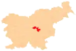
Mala Dolga Noga (Slovene pronunciation: [ˈmaːla ˈdoːu̯ɡa ˈnoːɡa]) is a former settlement in the Municipality of Litija in central Slovenia. It is now part of the village of Zgornja Jevnica.[1] The area is part of the traditional region of Upper Carniola and is now included with the rest of the municipality in the Central Sava Statistical Region.[2]
Geography
Mala Dolga Noga is located in the eastern part of Zgornja Jevnica, on a road climbing toward Bulantin Peak (Slovene: Bulantinov vrh, elevation: 645 meters or 2,116 feet) from the valley of Jevnica Creek.
History
In figures encompassing all of what is now Zgornja Jevnica, Mala Dolga Noga had a population of 118 living in 14 houses in 1880,[3] and 103 living in 15 houses in 1900.[4] Mala Dolga Noga was annexed by Jevnica in 1953, ending its existence as a separate settlement.[5] When Zgornja Jevnica became a separate settlement in 1989, Mala Dolga Noga was assigned to its territory.
References
- ↑ Kovič, Eva (2001). Pogled nazaj: poskus kronike Krajevne skupnosti Jevnica. Jevnica: Kulturno-umetniško društvo.
- ↑ Litija municipal site
- ↑ Special-Orts-Repertorium von Krain. Vienna: Alfred Hölder. 1884. p. 75.
- ↑ Leksikon občin kraljestev in dežel zastopanih v državnem zboru, vol. 6: Kranjsko. Vienna: C. Kr. Dvorna in Državna Tiskarna. 1906. p. 92.
- ↑ "Uredba o razglasitvi novih naselij in o združitvi naselij". Uradni list Ljudske republike Slovenije. 9 (2): 25. January 30, 1953. Retrieved April 7, 2022.
External links
 Media related to Mala Dolga Noga at Wikimedia Commons
- Mala Dolga Noga on Geopedia
