| Paugnut State Forest | |
|---|---|
 Paugnut State Forest's hills in autumn viewed from the north-east shore of Burr Pond. | |
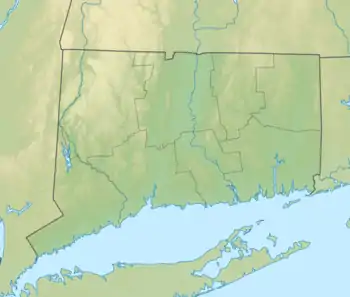
 Location in Connecticut  Paugnut State Forest (the United States) | |
| Location | Litchfield, Connecticut, United States |
| Coordinates | 41°51′21″N 73°06′08″W / 41.85583°N 73.10222°W[1] |
| Area | 1,644 acres (6.65 km2)[2] |
| Elevation | 1,099 ft (335 m)[1] |
| Established | 1929 [3] |
| Governing body | Connecticut Department of Energy and Environmental Protection |
| Website | Paugnut State Forest |
Paugnut State Forest is a Connecticut state forest located on four parcels in the towns of Torrington and Winchester.[4] The forest's Arts and Crafts–style administration building was constructed by the Civilian Conservation Corps in 1937[5] and has been listed on the National Register of Historic Places.[6] The remains of the foundation of the condensed milk factory established by Gail Borden on Burr Pond in 1857 may also be seen.[7][8] Trails crossing the forest include the John Muir Trail which connects Burr Pond State Park and Sunnybrook State Park.[9]
References
- 1 2 "Paugnut State Forest". Geographic Names Information System. United States Geological Survey, United States Department of the Interior.
- ↑ Legislative Program Review and Investigations Committee (January 23, 2014). "State Parks and Forests: Funding" (PDF). Staff Findings and Recommendations. Connecticut General Assembly. p. A-4. Retrieved March 20, 2014.
- ↑ "Connecticut State Forests Seedling Letterbox Series - Clues for Paugnut State Forest". State Parks and Forests. Connecticut Department of Energy and Environmental Protection. Retrieved September 30, 2013.
- ↑ "Paugnut State Forest". State Parks and Forests. Connecticut Department of Energy and Environmental Protection. Retrieved September 30, 2013.
- ↑ Connecticut Historical Commission (August 21, 1986). "Historic Resources Inventory Form". National Park Service. Retrieved June 23, 2015.
- ↑ "National Register of Historic Places Registration Form". National Park Service. September 5, 1986. Retrieved June 23, 2015.
- ↑ "World's First Condensed Milk Factory". The Historical Marker Database. Retrieved June 23, 2015.
- ↑ "Burr Pond State Park". State Parks and Forests. Connecticut Department of Energy and Environmental Protection. Retrieved June 23, 2015.
- ↑ "Paugnut State Forest: John Muir Trail" (PDF). Connecticut Bureau of Outdoor Recreation, State Parks Division. 2008. Retrieved June 23, 2015.
External links
- Paugnut State Forest Connecticut Department of Energy and Environmental Protection
- Paugnut State Forest Map Connecticut Department of Energy and Environmental Protection
This article is issued from Wikipedia. The text is licensed under Creative Commons - Attribution - Sharealike. Additional terms may apply for the media files.