Moravský Žižkov | |
|---|---|
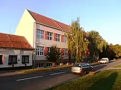
 Primary school | |
 Flag  Coat of arms | |
 Moravský Žižkov Location in the Czech Republic | |
| Coordinates: 48°49′58″N 16°55′53″E / 48.83278°N 16.93139°E | |
| Country | |
| Region | South Moravian |
| District | Břeclav |
| Founded | 1731 |
| Area | |
| • Total | 13.54 km2 (5.23 sq mi) |
| Elevation | 198 m (650 ft) |
| Population (2023-01-01)[1] | |
| • Total | 1,467 |
| • Density | 110/km2 (280/sq mi) |
| Time zone | UTC+1 (CET) |
| • Summer (DST) | UTC+2 (CEST) |
| Postal code | 691 01 |
| Website | www |
Moravský Žižkov is a municipality and village in Břeclav District in the South Moravian Region of the Czech Republic. It has about 1,500 inhabitants.
Geography
Moravský Žižkov is located about 8 kilometres (5 mi) north of Břeclav and 45 km (28 mi) southeast of Brno. It lies mostly in the Lower Morava Valley, The northern part of the municipal territory lies in the Kyjov Hills and includes the highest point of Moravský Žižkov at 260 m (850 ft) above sea level.
History
Founded in 1731, it is one of the youngest communities of the South Moravian Region. It was a part of Velké Bílovice until 1792, when it became a sovereign municipality.[2]
Demographics
|
|
| ||||||||||||||||||||||||||||||||||||||||||||||||||||||
| Source: Censuses[3][4] | ||||||||||||||||||||||||||||||||||||||||||||||||||||||||
Economy
In land, its register pertains big quantity of vineyards, arable land and fruit trees.
Sights
The main landmark of Moravský Žižkov is the Church of Our Lady Victorious. It is a modern church, built in 2000–2002.[5]
References
- ↑ "Population of Municipalities – 1 January 2023". Czech Statistical Office. 2023-05-23.
- ↑ "Historie a současnost" (in Czech). Obec Moravský Žižkov. Retrieved 2020-11-21.
- ↑ "Historický lexikon obcí České republiky 1869–2011 – Okres Břeclav" (in Czech). Czech Statistical Office. 2015-12-21. pp. 3–4.
- ↑ "Population Census 2021: Population by sex". Public Database. Czech Statistical Office. 2021-03-27.
- ↑ "Kostel Panny Marie Vítězné". Úžasná Morava.cz (in Czech). Retrieved 2023-06-21.