Malenovice | |
|---|---|
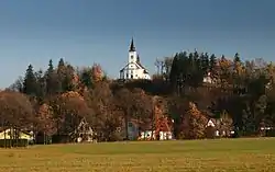
 View towards the Church of St. Ignatius of Loyola | |
_flag.svg.png.webp) Flag _CoA.svg.png.webp) Coat of arms | |
 Malenovice Location in the Czech Republic | |
| Coordinates: 49°34′46″N 18°24′37″E / 49.57944°N 18.41028°E | |
| Country | |
| Region | Moravian-Silesian |
| District | Frýdek-Místek |
| First mentioned | 1610 |
| Area | |
| • Total | 13.00 km2 (5.02 sq mi) |
| Elevation | 510 m (1,670 ft) |
| Population (2023-01-01)[1] | |
| • Total | 791 |
| • Density | 61/km2 (160/sq mi) |
| Time zone | UTC+1 (CET) |
| • Summer (DST) | UTC+2 (CEST) |
| Postal code | 739 11 |
| Website | www |
Malenovice is a municipality and village in Frýdek-Místek District in the Moravian-Silesian Region of the Czech Republic. It has about 800 inhabitants.
Etymology
The name is derived from malina, i.e. "raspberry". They grew abundantly here at the time the village was founded.[2]
Geography
Malenovice is located about 11 kilometres (7 mi) south of Frýdek-Místek and 25 km (16 mi) south of Ostrava, in the historical region of Cieszyn Silesia. Most of the municipal territory lies in the Moravian-Silesian Beskids, only a small part on the northwest lies in the Moravian-Silesian Foothills. The summit of the highest mountain of the Moravian-Silesian Beskids, Lysá hora at 1,323 metres (4,341 ft), is located on the southern municipal border.
History
The first written mention of Malenovice is from 1610. It was then a part of the Frýdek state country, which was a part of the Kingdom of Bohemia.[2]
Sights
The main landmark of Malenovice is the Church of Saint Ignatius of Loyola. It was built in the early Baroque style in 1673.[3]
References
- ↑ "Population of Municipalities – 1 January 2023". Czech Statistical Office. 23 May 2023.
- 1 2 "Historie" (in Czech). Obec Malenovice. Retrieved 23 February 2022.
- ↑ "Kostel sv. Ignáce" (in Czech). National Heritage Institute. Retrieved 13 August 2023.

