Leverkusen Chempark | |||||||||||
|---|---|---|---|---|---|---|---|---|---|---|---|
| Through station | |||||||||||
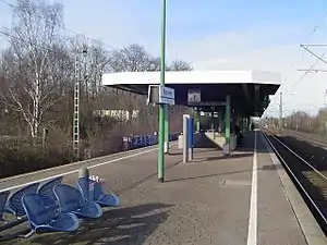
 Bayerwerk station in 2007 | |||||||||||
| General information | |||||||||||
| Location | Otto-Bayer-Str.10, Leverkusen, Cologne, North Rhine-Westphalia Germany | ||||||||||
| Coordinates | 51°00′41″N 6°59′48″E / 51.01137°N 6.99670°E | ||||||||||
| Line(s) | |||||||||||
| Other information | |||||||||||
| Station code | 437[1] | ||||||||||
| DS100 code | KBAY[2] | ||||||||||
| IBNR | 8000832 | ||||||||||
| Category | 5[1] | ||||||||||
| Fare zone | VRS: 2100 and 2200[3] | ||||||||||
| Website | www.bahnhof.de | ||||||||||
| History | |||||||||||
| Opened | 2 June 1991 [4] | ||||||||||
| Previous names | Bayerwerk | ||||||||||
| Services | |||||||||||
| |||||||||||
Leverkusen Chempark, till 2013 known as Bayerwerk[5] is a railway station on the Cologne–Duisburg railway, situated on the border of Leverkusen and Cologne in the German state of North Rhine-Westphalia.[6] It is named after the nearby Bayer chemical production plants. It is served by the S6 line of the Rhine-Ruhr S-Bahn at 20-minute intervals.[7][8]
It is also served by the following bus routes: 151 and 152 (operated by Kölner Verkehrs-Betriebe), 201 (operated by Kraftverkehr Wupper-Sieg) and 255 (operated by Kraftverkehr Gebr. Wiedenhoff), all at 20-minute intervals.[7]
See also
References
- 1 2 "Stationspreisliste 2024" [Station price list 2024] (PDF) (in German). DB Station&Service. 24 April 2023. Retrieved 29 November 2023.
- ↑ Eisenbahnatlas Deutschland (German railway atlas) (2009/2010 ed.). Schweers + Wall. 2009. ISBN 978-3-89494-139-0.
- ↑ "VRS-Gemeinschaftstarif" (PDF) (in German). Verkehrsverbund Rhein-Sieg. 20 April 2020. p. 202-203. Retrieved 9 May 2020.
- ↑ Joost, André. "Leverkusen Chempark station operations". NRW Rail Archive (in German). Retrieved 20 May 2020.
- ↑ Deutsche Bahn benennt S-Bahn-Haltestelle um
- ↑ "Bayerwerk station information including map" (in German). VKB. Retrieved 29 November 2013.
- 1 2 Joost, André. "Leverkusen Chempark station". NRW Rail Archive (in German). Retrieved 20 May 2020.
- ↑ "S-Bahn network map for the Cologne/Bonn Region" (PDF) (in German). Deutsche Bahn. Archived from the original (PDF) on 16 June 2012. Retrieved 29 November 2013.
This article is issued from Wikipedia. The text is licensed under Creative Commons - Attribution - Sharealike. Additional terms may apply for the media files.