Köln-Stammheim | |||||||||||
|---|---|---|---|---|---|---|---|---|---|---|---|
| Through station | |||||||||||
 | |||||||||||
| General information | |||||||||||
| Location | Dünnwalder Kommunalweg 22, Cologne, North Rhine-Westphalia Germany | ||||||||||
| Coordinates | 50°59′24″N 7°00′07″E / 50.9901°N 7.0019°E | ||||||||||
| Line(s) | |||||||||||
| Other information | |||||||||||
| Station code | 3338[1] | ||||||||||
| DS100 code | KKSH[2] | ||||||||||
| IBNR | 8003310 | ||||||||||
| Category | 5[1] | ||||||||||
| Fare zone | VRS: 2100[3] | ||||||||||
| Website | www.bahnhof.de | ||||||||||
| History | |||||||||||
| Opened | 2 June 1991 [4] | ||||||||||
| Services | |||||||||||
| |||||||||||
| Location | |||||||||||
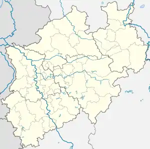
 Köln-Stammheim Location within North Rhine-Westphalia | |||||||||||
Köln-Stammheim is a railway station situated at Stammheim, Cologne in western Germany.[5] It is served by the S6 line of the Rhine-Ruhr S-Bahn at 20-minute intervals.[6][7] The station is located on a bridge over the L101 Dunnwalder Kommunalweg road.
References
- 1 2 "Stationspreisliste 2024" [Station price list 2024] (PDF) (in German). DB Station&Service. 24 April 2023. Retrieved 29 November 2023.
- ↑ Eisenbahnatlas Deutschland (German railway atlas) (2009/2010 ed.). Schweers + Wall. 2009. ISBN 978-3-89494-139-0.
- ↑ "VRS-Gemeinschaftstarif" (PDF) (in German). Verkehrsverbund Rhein-Sieg. 20 April 2020. p. 202. Archived from the original (PDF) on 11 June 2020. Retrieved 9 May 2020.
- ↑ Joost, André. "Köln-Stammheim station operations". NRW Rail Archive (in German). Retrieved 20 May 2020.
- ↑ "Map of Köln-Stammheim station" (PDF) (in German). VKB. Retrieved 29 November 2013.
- ↑ Joost, André. "Köln-Stammheim station". NRW Rail Archive (in German). Retrieved 20 May 2020.
- ↑ "S-Bahn network map for the Cologne/Bonn Region" (PDF) (in German). Deutsche Bahn. Archived from the original (PDF) on 16 June 2012. Retrieved 29 November 2013.
This article is issued from Wikipedia. The text is licensed under Creative Commons - Attribution - Sharealike. Additional terms may apply for the media files.