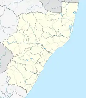
KwaCele | |
|---|---|
Village | |
| KwaCele | |
 KwaCele  KwaCele  KwaCele | |
| Coordinates: 30°15′09″S 30°41′24″E / 30.2525°S 30.6900°E | |
| Country | South Africa |
| Province | KwaZulu-Natal |
| District | Ugu District Municipality |
| Municipality | Umdoni Local Municipality |
| Named for | Cele Tribe |
| Government | |
| • Type | Mayor-council government |
| Elevation | 527 m (1,729 ft) |
| Population (2011) | |
| • Total | 4,252 |
| Time zone | UTC+2 (SAST) |
| Postal code (street) | 4180 |
| PO box | 4180 |
| Area code | 039 |
KwaCele is a small village located on the south coast region of KwaZulu-Natal, South Africa. The village is run by the chief of the Cele Traditional Council.[1]
Demography
In 2011, the population of the village was recorded as 4,252 in an area of 1.728 km.[2]
Geography
The village is located on the South Coast region of KwaZulu-Natal, with neighboring township such as Amahlongwa, Amandawe, Dududu, Umzinto.
Education
In the village there is a large number of primary schools namely:
- Celokuhle Junior Primary
- Shonkweni Junior primary[3]
- Amacebo primary school
References
This article is issued from Wikipedia. The text is licensed under Creative Commons - Attribution - Sharealike. Additional terms may apply for the media files.