Amahlongwa | |
|---|---|
Township | |
| Amahlongwa Mission | |
 Amahlongwa  Amahlongwa  Amahlongwa | |
| Coordinates: 30°14′10″S 30°43′04″E / 30.2360°S 30.7178°E[1] | |
| Country | South Africa |
| Province | KwaZulu-Natal |
| District | Ugu District Municipality |
| Municipality | uMdoni Local Municipality |
| Named for | Amahlongwa River [2] |
| Government | |
| • Type | Mayor-council government |
| Area | |
| • Total | 10.12 km2 (3.91 sq mi) |
| Population (2011) | |
| • Total | 7,455 |
| • Density | 615.86/km2 (1,595.1/sq mi) |
| Demonym | Amahlongwan |
| Racial makeup (2011) | |
| First languages (2011) | |
| Time zone | UTC+2 (SAST) |
| Postal code (street) | 4170 |
| PO box | 4180 |
| Area code | 039 |
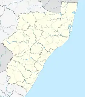
Amahlongwa Mission or simply known as Amahlongwa and oftely informally abbreviated as A.M.H is a small township on the south coast region of KwaZulu-Natal.
Demography
The population of the township in 2011 was 7,455 people with 1,591 households.[5] It also has an area of 12.10 kilometer squared, with an elevation of 554m above sea level.
Religion
Churches in the area include :
Geography
Location
It is under the Umdoni Local Municipality, with neighboring townships such as Amandawe, Dududu, KwaCele, Clausthal.
Wildlife
The township has a large number of animals such as Black mambas,[6][7] brown house snake, Spotted bush snake, etc.
Notable people
- Sandile Ngidi - A poet, journalist[8]
References
- ↑ Amahlongwa Geoview
- ↑ Census 2011 Statistics South Africa
- ↑ Census 2011 Statistics South Africa
- ↑ Census 2011 Statistics South Africa
- ↑ Black mamba arrives at KZN school news24.com
- ↑ Black mamba arrives at KZN school news24.com
- ↑ Al Jazeera
This article is issued from Wikipedia. The text is licensed under Creative Commons - Attribution - Sharealike. Additional terms may apply for the media files.