Ironwood Township, Michigan | |
|---|---|
| Charter Township of Ironwood | |
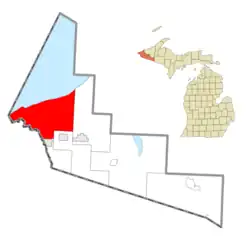
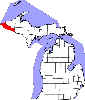
 Location within Gogebic County | |
 Ironwood Township Location within the state of Michigan | |
| Coordinates: 46°32′49″N 90°08′35″W / 46.54694°N 90.14306°W | |
| Country | United States |
| State | Michigan |
| County | Gogebic |
| Government | |
| • Supervisor | Jay Kangas |
| • Clerk | Mary Segalin |
| Area | |
| • Total | 188.93 sq mi (488.99 km2) |
| • Land | 175.40 sq mi (454.28 km2) |
| • Water | 13.53 sq mi (34.71 km2) |
| Elevation | 1,145 ft (349 m) |
| Population (2020) | |
| • Total | 1,805 |
| • Density | 13.3/sq mi (5.1/km2) |
| Time zone | UTC-6 (Central (CST)) |
| • Summer (DST) | UTC-5 (CDT) |
| ZIP code(s) | |
| Area code | 906 |
| FIPS code | 26-41080[1] |
| GNIS feature ID | 1626529[2] |
| Website | Official website |
Ironwood Charter Township is a charter township of Gogebic County in the U.S. state of Michigan. The population was 1,805 in 2020.[3] The city of Ironwood borders on the south, but the two are administered autonomously.
Ironwood Township is the home of Gogebic Community College, as well as the Gogebic–Iron County Airport. Most of the land in the township is within the Ottawa National Forest. The Montreal River forms the township's western boundary with Wisconsin. Ironwood Charter Township is the westernmost municipality in the state of Michigan. It is also the largest charter township by land area and the least-densely populated charter township in the state.
Geography
According to the United States Census Bureau, the township has a total area of 188.93 square miles (489.33 km2), of which 175.40 square miles (454.28 km2) is land and 13.53 square miles (35.04 km2) (7.10%) is water.[4]
Demographics
In 2000, there were 2,330 people, 1,024 households, and 699 families residing in the township.[1] At the 2010 census, its population was 2,3333.[4] By 2020, its population was 1,805.[3]
References
- 1 2 "U.S. Census website". United States Census Bureau. Retrieved 2008-01-31.
- ↑ U.S. Geological Survey Geographic Names Information System: Ironwood Charter Township, Michigan
- 1 2 "Explore Census Data". data.census.gov. Retrieved 2023-12-10.
- 1 2 "Michigan: 2010 Population and Housing Unit Counts 2010 Census of Population and Housing" (PDF). 2010 United States Census. United States Census Bureau. September 2012. p. 22 Michigan. Archived (PDF) from the original on 2012-10-19. Retrieved October 1, 2021.
