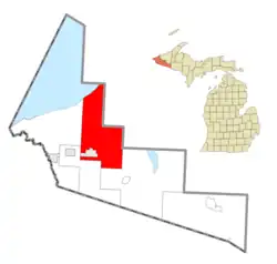
Wakefield Township, Michigan | |
|---|---|
 Location within Gogebic County | |
 Wakefield Township Location within the state of Michigan  Wakefield Township Wakefield Township (the United States) | |
| Coordinates: 46°31′53″N 89°52′11″W / 46.53139°N 89.86972°W | |
| Country | United States |
| State | Michigan |
| County | Gogebic |
| Government | |
| • Supervisor | John Cox |
| • Clerk | Mandy Lake |
| Area | |
| • Total | 180.8 sq mi (468.2 km2) |
| • Land | 179.8 sq mi (465.6 km2) |
| • Water | 1.0 sq mi (2.5 km2) |
| Elevation | 1,421 ft (433 m) |
| Population (2020) | |
| • Total | 301 |
| • Density | 2.0/sq mi (0.8/km2) |
| Time zone | UTC-6 (Central (CST)) |
| • Summer (DST) | UTC-5 (CDT) |
| ZIP code(s) | |
| Area code | 906 |
| FIPS code | 26-82800[1] |
| GNIS feature ID | 1627205[2] |
| Website | Official website |
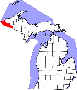
Wakefield Township is a civil township of Gogebic County in the U.S. state of Michigan. The population was 301 in 2020.[3]
Geography
According to the United States Census Bureau, the township has a total area of 180.8 square miles (468 km2), of which 179.8 square miles (466 km2) is land and 1.0 square mile (2.6 km2) (0.54%) is water.
Communities
- The City of Wakefield is situated within the township, but is administratively autonomous.
- Duke was a lumbertown in this township with a station on the Duluth, South Shore and Atlantic Railroad. It had a post office from 1901 until 1906.[4]
- Thomaston is an unincorporated community in the township a few miles north of Wakefield at 46°30′59″N 89°55′39″W / 46.51639°N 89.92750°W.[5] A post office opened November 7, 1891 and was discontinued July 31, 1923. The office reopened and operated from January 12, 1925, until August 14, 1926.[6]
- Connorville is an unincorporated community in the township a few miles north of Thomaston at 46°33′07″N 89°55′52″W / 46.55194°N 89.93111°W.[7] It began as a lumber camp in 1925.[8]
- Tula was a lumbertown approximately 8 miles of the City of Wakefield east on M-28 at 46°32′46″N 89°48′53″W / 46.54611°N 89.81472°W. It had a post office from 1906 until 1916.[9] There is a sign approximately 1+1⁄2 miles east of the former town site that reads "Tula".
Demographics
As of the census[1] of 2000, there were 364 people, 161 households, and 110 families residing in the township. In 2020, there were 301 people residing in the township.[3]
References
Notes
- 1 2 "U.S. Census website". United States Census Bureau. Retrieved January 31, 2008.
- ↑ U.S. Geological Survey Geographic Names Information System: Wakefield Township, Michigan
- 1 2 "Explore Census Data". data.census.gov. Retrieved December 10, 2023.
- ↑ Romig 1986, p. 164.
- ↑ U.S. Geological Survey Geographic Names Information System: Thomaston, Michigan
- ↑ U.S. Geological Survey Geographic Names Information System: Thomaston Post Office (historical)
- ↑ U.S. Geological Survey Geographic Names Information System: Connorville, Michigan
- ↑ Romig 1986, p. 130.
- ↑ "MICHIGAN GHOST TOWN: Tula, the Town That Isn't There". 99.1 WFMK. Retrieved February 25, 2020.
Sources
- Romig, Walter (October 1, 1986) [1973]. Michigan Place Names: The History of the Founding and the Naming of More Than Five Thousand Past and Present Michigan Communities (Paperback). Detroit, Michigan: Wayne State University Press. ISBN 978-0814318386.
{{cite book}}:|work=ignored (help)
This article is issued from Wikipedia. The text is licensed under Creative Commons - Attribution - Sharealike. Additional terms may apply for the media files.
