 | |
| Państwo | |
|---|---|
| Region | |
| Wysokość |
479 m n.p.m. |
| Populacja (2013) • liczba ludności |
|
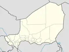
Położenie na mapie Nigru  | |
Zinder – miasto w południowym Nigrze, ośrodek administracyjny regionu Zinder, na transsaharyjskim szlaku z Algierii do Nigerii. Ludność: 261 tys. mieszkańców (2013). Drugie pod względem liczby ludności miasto kraju.
Przypisy
- ↑ Niger: largest cities and towns and statistics of their population. World Gazetter. [dostęp 2016-01-23]. [zarchiwizowane z tego adresu (2013-04-28)].
This article is issued from Wikipedia. The text is licensed under Creative Commons - Attribution - Sharealike. Additional terms may apply for the media files.