 | |
| Kontynent | |
|---|---|
| Państwo | |
| Akwen | |
| Archipelag | |
| Powierzchnia |
172 km² |
| Populacja (2010) • liczba ludności |
|
Położenie na mapie Indonezji  | |
| 4°35′00″S 129°55′00″E/-4,583333 129,916667 | |
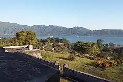
Wyspy Banda (indonez. Kepulauan Banda) – archipelag w Indonezji na morzu Banda; wchodzi w skład prowincji Moluki[1]; powierzchnia 172 km²; ok. 19 tys. mieszkańców (2010)[2]. Administracyjnie tworzą kecamatan w kabupatenie Moluki Środkowe (Maluku Tengah)[1].
Na wyspach jest używany malajski wysp Banda (bahasa Banda)[3].
Z wysp Banda pochodzi gałka muszkatołowa[4].
Przypisy
- 1 2 Upacara tradisional yang berkaitan dengan peristiwa alam dan kepercayaan daerah Maluku, Departemen Pendidikan dan Kebudayaan, Proyek Inventarisasi dan Dokumentasi Kebudayaan Daerah, 1985, s. 24 (indonez.).
- ↑ Biro Pusat Statistik, Dżakarta, 2011
- ↑ Winn 2007 ↓, s. 90.
- ↑ Moore 2003 ↓, s. 59.
Bibliografia
- Clive Moore, New Guinea: Crossing Boundaries and History, Honolulu: University of Hawaiʻi Press, 2003, DOI: 10.2307/j.ctvsrfkh, ISBN 0-8248-2485-7, OCLC 51613921, JSTOR: j.ctvsrfkh (ang.).
- Phillip Winn: The Southeast Asian exception and "unforeseen results": Unfree labour in the Banda Islands. W: Maria Suzette Fernandes Dias (red.): Legacies of Slavery: Comparative Perspectives. Newcastle, UK: Cambridge Scholars Publishing, 2007, s. 76–106. ISBN 978-1-5275-6700-9. ISBN 978-1-8471-8111-4. OCLC 654375913. (ang.).
Linki zewnętrzne
- The Bandas: Beautiful Nutmeg Islands. East-Indonesia.info. [dostęp 2023-09-18]. (ang.).
This article is issued from Wikipedia. The text is licensed under Creative Commons - Attribution - Sharealike. Additional terms may apply for the media files.