| |||||
| Państwo | |||||
|---|---|---|---|---|---|
| Stan | |||||
| Data założenia |
1904 | ||||
| Powierzchnia |
295,650[1] km² | ||||
| Wysokość |
255 m n.p.m. | ||||
| Populacja (2010) • liczba ludności • gęstość |
| ||||
| Nr kierunkowy |
47 | ||||
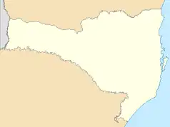
Położenie na mapie Santa Catarina  | |||||
Położenie na mapie Brazylii  | |||||
| Strona internetowa | |||||
Presidente Getúlio – miasto i gmina w Brazylii, w stanie Santa Catarina. Znajduje się w mezoregionie Vale do Itajaí i mikroregionie Rio do Sul.
Przypisy
- ↑ territorial oficial. sc.gov.br:80. [zarchiwizowane z tego adresu (2013-02-18)].
- ↑ Censo Populacional 2010
This article is issued from Wikipedia. The text is licensed under Creative Commons - Attribution - Sharealike. Additional terms may apply for the media files.
.svg.png.webp)
.svg.png.webp)