| Państwo | |
|---|---|
| Dystrykt |
Iganga |
| Wysokość |
1120 m n.p.m. |
| Populacja (2011) • liczba ludności |
|
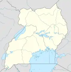
Położenie na mapie Ugandy  | |
Iganga – miasto we wschodniej Ugandzie. Liczy 53700 mieszkańców[1]. Stolica, główne miejskie, administracyjne i handlowe centrum Dystryktu Iganga.
Przypisy
- ↑ ubos.org. ubos.org. [zarchiwizowane z tego adresu (2019-04-11)]..
This article is issued from Wikipedia. The text is licensed under Creative Commons - Attribution - Sharealike. Additional terms may apply for the media files.