| dystrykt niemetropolitalny | |||||
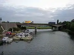
 A14, Huntingdon | |||||
| |||||
| Państwo | |||||
|---|---|---|---|---|---|
| Kraj | |||||
| Region | |||||
| Hrabstwo | |||||
| Siedziba | |||||
| Powierzchnia |
912,5 km² | ||||
| Populacja (2011) • liczba ludności |
| ||||
| • gęstość |
190 os./km² | ||||
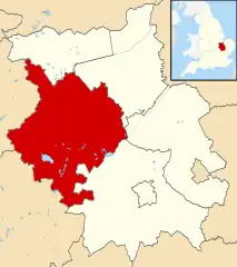
Położenie na mapie Cambridgeshire | |||||
| Strona internetowa | |||||
Huntingdonshire – dystrykt w hrabstwie Cambridgeshire oraz historyczne hrabstwo w Anglii. W 2011 roku dystrykt liczył 169 508 mieszkańców[1].
Miasta
Inne miejscowości
Abbots Ripton, Abbotsley, Alconbury, Alconbury Weston, Alwalton, Barham and Woolley, Barham, Bluntisham, Brampton, Brington, Broughton, Buckden, Buckworth, Bury, Bythorn, Bythorn and Keyston, Caldecote, Catworth, Chesterton, Colne, Conington, Coppingford, Covington, Denton, Diddington, Earith, Easton, Eaton Socon, Ellington, Elton, Eynesbury, Farcet, Fenstanton, Folksworth, Glatton, Grafham, Great Gidding, Great Gransden, Great Paxton, Great Staughton, Great Stukeley, Haddon, Hail Weston, Hamerton, Hartford, Hemingford Abbots, Hemingford Grey, Holme, Holywell, Houghton, Keyston, Kimbolton, Kings Ripton, Leighton Bromswold, Little Gidding, Little Paxton, Little Stukeley, Morborne, Needingworth, Offord D'Arcy, Old Hurst, Old Weston, Perry, Pidley, Ramsey Heights, Ramsey Mereside, Ramsey St Mary’s, Sawtry, Sibson, Sibson-cum-Stibbington, Somersham, Southoe, Southoe and Midloe, Spaldwick, Stibbington, Stilton, Stow Longa, Tetworth, The Offords, The Raveleys, The Stukeleys, Tilbrook, Upwood, Warboys, Waresley, Water Newton, Winwick, Wistow, Woodhurst, Wood Walton, Woolley, Yaxley, Yelling.
Przypisy
- ↑ Area: Huntingdonshire (Local Authority). Neighbourhood Statistics (ONS). [dostęp 2016-05-06]. [zarchiwizowane z tego adresu (2016-10-10)]. (ang.).

