| Hrabstwo | |
| Państwo | |
|---|---|
| Prowincja | |
| Siedziba | |
| Powierzchnia |
2 696,53 km² |
| Populacja (2016) • liczba ludności |
|
| • gęstość |
10,1 os./km² |
| Plan | |
 | |
Położenie na mapie | |
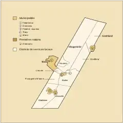
Sunbury – historyczne hrabstwo (county) kanadyjskiej prowincji Nowy Brunszwik z ośrodkiem kolejno w: Maugerville, Burton i Oromocto, powstałe w 1765, współcześnie jednostka podziału statystycznego (census division)[1]. Według spisu powszechnego z 2016 obszar hrabstwa to: 2696,53 km², a zamieszkiwało wówczas ten obszar 27 644 osób[2].
Hrabstwo, którego nazwa pochodzi od tytułu George’a Montagu Dunka (m.in. wicehrabiego Sunbury), zostało wydzielone 30 kwietnia 1765 z nowoszkockiego hrabstwa Cumberland (delimitacja granicy w 1770) i do podziału w 1786 (w konsekwencji wydzielenia kolonii Nowy Brunszwik) obejmowało również całą pozostałą zachodnią część współczesnej prowincji (tj. dolinę rzeki Saint John i tereny wokół zatoki Passamaquoddy Bay)[3].
Według spisu powszechnego z 2011 obszar hrabstwa zamieszkiwało 27 143 mieszkańców; język angielski był językiem ojczystym dla 89,6%, francuski dla 8,8% mieszkańców[4].
Przypisy
- ↑ Sunbury [online], Natural Resources Canada / Ressources naturelles Canada – nrcan.gc.ca [dostęp 2021-05-03]; Sunbury, County [Census division], New Brunswick and New Brunswick [Province] – Census Profile, 2016 Census [online], Statistics Canada / Statistique Canada – statcan.gc.ca [dostęp 2021-05-03]; An Act for the better ascertaining and confirming the Boundaries of the several Counties within this Province, and for subdividing them into Towns and Parishes, [w:] The Acts of the General Assembly of His Majesty’s Province of New Brunswick, from the twenty-sixth year to the end of the reign of king George the Third, Fredericton 1824, s. 5, 18–19; W.B. Hamilton, Sunbury County, [w:] W.B. Hamilton, Place Names of Atlantic Canada, Toronto–Buffalo–London: University of Toronto Press, 1996, s. 140; L.H. Taché, A legal hand-book and law-list for the Dominion of Canada and a book of parliamentary and general information, Toronto: Carswell & Co., Law Publishers, 1888, s. 381.
- ↑ Sunbury, County [Census division], New Brunswick and New Brunswick [Province] – Census Profile, 2016 Census [online], Statistics Canada / Statistique Canada – statcan.gc.ca [dostęp 2021-05-03].
- ↑ W.F. Ganong, A monograph of the evolution of the boundaries of the province of New Brunswick miejsce = Ottawa–Toronto–London, England, J. Hope & Sons–The Copp-Clark Co.–Bernard Quaritch, 1901, s. 226; W.B. Hamilton, Sunbury County, [w:] W.B. Hamilton, Place Names of Atlantic Canada, Toronto–Buffalo–London: University of Toronto Press, 1996, s. 312–313;
- ↑ Sunbury, County [Census division], New Brunswick and New Brunswick [Province] – Census Profile [online], Statistics Canada / Statistique Canada – statcan.gc.ca [dostęp 2021-05-03].