| hrabstwo | |
 | |
| Państwo | |
|---|---|
| Stan | |
| Siedziba | |
| Kod statystyczny |
FIPS 6-4: 46077 |
| Powierzchnia |
2236,89 km²[1] |
| Populacja (2009) • liczba ludności |
|
Położenie na mapie Dakota Południowa | |
| 44°22′12″N 97°29′24″W/44,370000 -97,490000 | |
| Strona internetowa | |
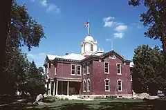
Hrabstwo Kingsbury (ang. Kingsbury County) – hrabstwo w stanie Dakota Południowa w Stanach Zjednoczonych. Obszar całkowity hrabstwa obejmuje powierzchnię 863,67 mil² (2236,89 km²). Według szacunków United States Census Bureau w roku 2009 miało 5308 mieszkańców[2].
Hrabstwo powstało w 1873 roku[3]. Na jego terenie znajdują się następujące gminy (townships): Baker, Denver, Esmond, Hartland, Le Sueur, Manchester, Mathews, Spirit Lake, Spring Lake.[4]
Miejscowości
Przypisy
- ↑ US Census Bureau: Population, Housing Units, Area, and Density: 2000. [dostęp 2012-08-29]. [zarchiwizowane z tego adresu (2015-07-08)]. (ang.).
- 1 2 US Census Bureau: Kingsbury County. Quickfacts. [dostęp 2010-12-04]. (ang.).
- ↑ Kingsbury County, SD. National Association of Counties. [dostęp 2010-12-04]. (ang.).
- ↑ Places in Kingsbury County. National Association of Counties. [dostęp 2010-12-04]. (ang.).
This article is issued from Wikipedia. The text is licensed under Creative Commons - Attribution - Sharealike. Additional terms may apply for the media files.