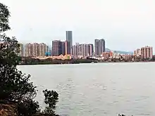
Wu Shek Kok and Starling Inlet seen from Luk Keng Road.

Tin Hau Temple in Wu Shek Kok. The right part of the building houses a Hip Tin Temple.

View of Shenzhen from Wu Shek Kok.
Wu Shek Kok (Chinese: 烏石角) is a village in Sha Tau Kok, North District, Hong Kong.
Administration
Wu Shek Kok is a recognized village under the New Territories Small House Policy.[1] It is one of the villages represented within the Sha Tau Kok District Rural Committee. For electoral purposes, Wu Shek Kok is part of the Sha Ta constituency, which is currently represented by Ko Wai-kei.[2][3]
History
The villages of Ma Tseuk Leng (upper and lower), Yim Tso Ha, Wu Shek Kok and Au Ha formed a yeuk (約),[4] a form of oath-sworn, inter-village, mutual-aid alliance.[5]
Features
There is a Tin Hau temple in Wu Shek Kok.[6]
Japanese World War II military facilities are located on a hill at Wu Shek Kok.[7]
See also
Further reading
- Hase, Patrick (1993). "Eastern Peace: Sha Tau Kok Market in 1925" (PDF). Journal of the Royal Asiatic Society Hong Kong Branch. 33: 147–202. ISSN 1991-7295.
References
- ↑ "List of Recognized Villages under the New Territories Small House Policy" (PDF). Lands Department. September 2009.
- ↑ "Recommended District Council Constituency Areas (North District)" (PDF). Electoral Affairs Commission. Retrieved 19 October 2021.
- ↑ "North District Council - North DC Members". District Council. Retrieved 19 October 2021.
- ↑ Faure, David (1986). The structure of Chinese rural society: lineage and village in the eastern New Territories, Hong Kong. Oxford University Press. p. 217. ISBN 9780195839708.
- ↑ Hase, Patrick H. (2013). Custom, Land and Livelihood in Rural South China: The Traditional Land Law of Hong Kong's New Territories, 1750-1950. Royal Asiatic Society Hong Kong Studies Series. Hong Kong University Press. p. 10. ISBN 978-988-8139-08-8.
- ↑ Chinese Temples Committee: Tin Hau Kung, Wu Shek Kong
- ↑ "Survey Findings on Japanese World War II Military Installations in Hong Kong" (PDF). Surveying & Built Environment. Hong Kong Institute of Surveyors (Special issue to commemorate the 70th Anniversary of the Battle of Hong Kong, 8 December to 25 December 1941): 83–84. 2011.
External links
Wikimedia Commons has media related to Wu Shek Kok.
This article is issued from Wikipedia. The text is licensed under Creative Commons - Attribution - Sharealike. Additional terms may apply for the media files.