Wijk en Aalburg | |
|---|---|
Village | |
 Near Wijk en Aalburg, view of the village | |
 Coat of arms | |
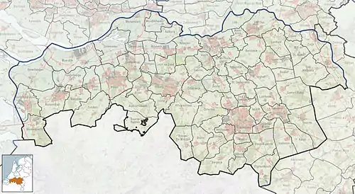
 Wijk en Aalburg Location in the province of North Brabant in the Netherlands  Wijk en Aalburg Wijk en Aalburg (Netherlands) | |
| Coordinates: 51°45′15″N 5°7′50″E / 51.75417°N 5.13056°E | |
| Country | Netherlands |
| Province | North Brabant |
| Municipality | Altena |
| Area | |
| • Total | 16.08 km2 (6.21 sq mi) |
| Elevation | 1.6 m (5.2 ft) |
| Population (2021)[1] | |
| • Total | 5,100 |
| • Density | 320/km2 (820/sq mi) |
| Time zone | UTC+1 (CET) |
| • Summer (DST) | UTC+2 (CEST) |
| Postal code | 4261[1] |
| Dialing code | 0416 |
Wijk en Aalburg is a village in the Dutch province of North Brabant. It is located in the municipality of Altena, about 15 km northwest of 's-Hertogenbosch.
History
Aalburg was first mentioned in 889 as Alburch. The etymology is unclear.[3] Wijk was first mentioned in 1208 as Wic and means "neighbourhood".[4] Both villages developed along the Afgedamde Maas in the Middle Ages and merged into a single settlement. The villages were frequently flooded.[5]
The tower of the Dutch Reformed church of Aalburg probably dates from the 14th century. The church has been extensively modified in 1630. The church of Wijk is a basilica like church which was extensively altered in the 18th century.[5]
In 1813, during the French occupation, the administrative system of the Netherlands was reformed and old rights and privileges were abolished. On 31 January 1816, after the establishment of the Kingdom of the Netherlands, the Province of North Brabant decided to rent out the floodplains of the river. The mayor of Wijk sued the Province, because the area was a communal ground according to old privileges. On 3 June 1817, the court ruled that the floodplains are communal grounds.[6]
In 1840, Wijk has home to 1,229 people and Aalburg was home to 486 people.[6] Wijk en Aalburg was a separate municipality until 1973, when it merged with Eethen and Veen to form the new municipality of Aalburg.[7] In 2019, it was merged into Altena.[6]
Gallery
 Wijk en Aalburg, monumental farmhouse
 Wijk en Aalburg, Windmill: Stellingmolen (a high windmill with gallery) - "de Twee Gebroeders"
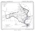
 Wijk en Aalburg in 1865
 Removing a yacht from the marina
References
- 1 2 3 "Kerncijfers wijken en buurten 2021". Central Bureau of Statistics. Retrieved 15 April 2022.
Spijk has been subtracted
- ↑ "Postcodetool for 4261AA". Actueel Hoogtebestand Nederland (in Dutch). Het Waterschapshuis. Retrieved 15 April 2022.
- ↑ "Aalburg (geografische naam)". Etymologiebank (in Dutch). Retrieved 15 April 2022.
- ↑ "Wijk (geografische naam)". Etymologiebank (in Dutch). Retrieved 15 April 2022.
Authenticity of 1135 reference is in doubt
- 1 2 Chris Kolman & Ronald Stenvert (1997). Wijk en Aalburg (in Dutch). Zwolle: Waanders. ISBN 90 400 9945 6. Retrieved 15 April 2022.
- 1 2 3 "Wijk en Aalburg". Plaatsengids (in Dutch). Retrieved 15 April 2022.
- ↑ Ad van der Meer and Onno Boonstra, Repertorium van Nederlandse gemeenten, KNAW, 2011.