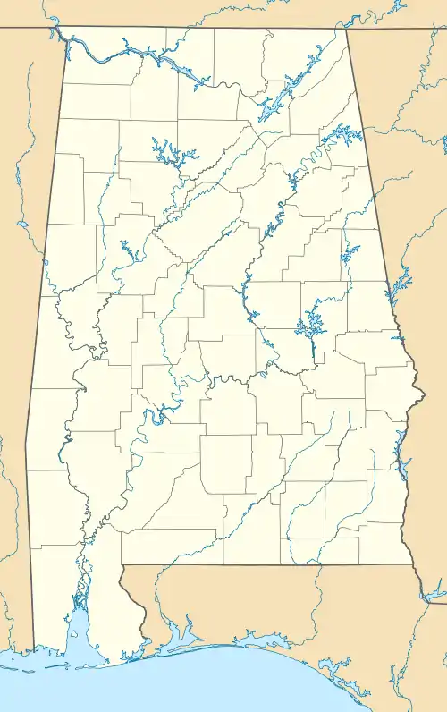
Whatley, Alabama | |
|---|---|
 Location of Whatley in Clarke County, Alabama. | |
 Whatley Location within the state of Alabama | |
| Coordinates: 31°39′3″N 87°42′18″W / 31.65083°N 87.70500°W | |
| Country | United States |
| State | Alabama |
| County | Clarke |
| Area | |
| • Total | 1.29 sq mi (3.34 km2) |
| • Land | 1.29 sq mi (3.34 km2) |
| • Water | 0.00 sq mi (0.00 km2) |
| Elevation | 154 ft (47 m) |
| Population (2020) | |
| • Total | 167 |
| • Density | 129.36/sq mi (49.94/km2) |
| Time zone | UTC-6 (Central (CST)) |
| • Summer (DST) | UTC-5 (CDT) |
| Area code | 251 |
| GNIS ID | 153954[2] |
Whatley is a census-designated place in Clarke County, Alabama, United States. As of the 2010 census, its population was 225.[3] It is named in honor of Franklin Benjamin Whatley. It has one site on the National Register of Historic Places, the Whatley Historic District.[4]
History
Whatley was previously an incorporated community in 1901 and recorded a population of 187 according to the 1910 U.S. Census. It did not report any population figure again until 2010 when it became a census-designated place.
| Census | Pop. | Note | %± |
|---|---|---|---|
| 1910 | 187 | — | |
| 2010 | 150 | — | |
| 2020 | 167 | 11.3% | |
| U.S. Decennial Census[5] | |||
During the racial violence of Red Summer of 1919 there was a gun battle between the Whatley White and Black communities on August 1, 1919, there was a Whatley, Alabama race riot. And in the same year a person named Archie Robinson got lynched.
Geography
Whatley is located southeast of the center of Clarke County at 31°39′03″N 87°42′18″W / 31.65083°N 87.70500°W.
Climate
| Climate data for Whatley, Alabama, 1991–2020 normals, extremes 1956–2007 | |||||||||||||
|---|---|---|---|---|---|---|---|---|---|---|---|---|---|
| Month | Jan | Feb | Mar | Apr | May | Jun | Jul | Aug | Sep | Oct | Nov | Dec | Year |
| Record high °F (°C) | 84 (29) |
86 (30) |
92 (33) |
92 (33) |
98 (37) |
104 (40) |
104 (40) |
103 (39) |
101 (38) |
95 (35) |
88 (31) |
83 (28) |
104 (40) |
| Mean daily maximum °F (°C) | 59.2 (15.1) |
62.8 (17.1) |
70.6 (21.4) |
77.0 (25.0) |
83.7 (28.7) |
88.7 (31.5) |
90.6 (32.6) |
91.4 (33.0) |
87.1 (30.6) |
78.0 (25.6) |
68.4 (20.2) |
60.7 (15.9) |
76.5 (24.7) |
| Daily mean °F (°C) | 46.3 (7.9) |
50.2 (10.1) |
57.2 (14.0) |
64.2 (17.9) |
71.8 (22.1) |
78.1 (25.6) |
80.4 (26.9) |
80.5 (26.9) |
76.0 (24.4) |
65.4 (18.6) |
55.5 (13.1) |
48.9 (9.4) |
64.5 (18.1) |
| Mean daily minimum °F (°C) | 33.3 (0.7) |
37.6 (3.1) |
43.8 (6.6) |
51.4 (10.8) |
59.9 (15.5) |
67.5 (19.7) |
70.1 (21.2) |
69.7 (20.9) |
65.0 (18.3) |
52.8 (11.6) |
42.6 (5.9) |
37.0 (2.8) |
52.6 (11.4) |
| Record low °F (°C) | −2 (−19) |
6 (−14) |
13 (−11) |
26 (−3) |
34 (1) |
40 (4) |
50 (10) |
51 (11) |
35 (2) |
25 (−4) |
14 (−10) |
2 (−17) |
−2 (−19) |
| Average precipitation inches (mm) | 5.52 (140) |
5.19 (132) |
5.84 (148) |
4.31 (109) |
4.10 (104) |
5.76 (146) |
6.24 (158) |
5.48 (139) |
3.88 (99) |
4.10 (104) |
4.46 (113) |
6.50 (165) |
61.38 (1,557) |
| Average snowfall inches (cm) | 0.2 (0.51) |
0.0 (0.0) |
0.0 (0.0) |
0.0 (0.0) |
0.0 (0.0) |
0.0 (0.0) |
0.0 (0.0) |
0.0 (0.0) |
0.0 (0.0) |
0.0 (0.0) |
0.0 (0.0) |
0.2 (0.51) |
0.4 (1.02) |
| Average precipitation days (≥ 0.01 in) | 9.7 | 8.2 | 8.0 | 6.5 | 6.2 | 9.8 | 11.3 | 8.7 | 6.8 | 6.1 | 7.4 | 7.5 | 96.2 |
| Average snowy days (≥ 0.1 in) | 0.1 | 0.0 | 0.0 | 0.0 | 0.0 | 0.0 | 0.0 | 0.0 | 0.0 | 0.0 | 0.0 | 0.1 | 0.2 |
| Source 1: NOAA[6] | |||||||||||||
| Source 2: XMACIS2[7] | |||||||||||||
Notable Resident
Birthplace of Trombonist Grover Mitchell
References
- ↑ "2020 U.S. Gazetteer Files". United States Census Bureau. Retrieved October 29, 2021.
- ↑ "Whatley". Geographic Names Information System. United States Geological Survey, United States Department of the Interior.
- ↑ "Geographic Identifiers: 2010 Demographic Profile Data (G001): Whatley CDP, Alabama". U.S. Census Bureau, American Factfinder. Archived from the original on February 12, 2020. Retrieved June 5, 2014.
- ↑ "National Register Information System". National Register of Historic Places. National Park Service. March 13, 2009.
- ↑ "U.S. Decennial Census". Census.gov. Retrieved June 6, 2013.
- ↑ "U.S. Climate Normals Quick Access – Station: Whatley, AL". National Oceanic and Atmospheric Administration. Retrieved March 4, 2023.
- ↑ "xmACIS2". National Oceanic and Atmospheric Administration. Retrieved March 4, 2023.
