| Watonga Lake | |
|---|---|
 Watonga Lake  Watonga Lake | |
| Location | Blaine County, Oklahoma |
| Coordinates | 35°56′33″N 98°25′23″W / 35.9423635°N 98.4230317°W |
| Type | Reservoir |
| Built | 1955 |
| Max. depth | 26 feet (7.9 m) |
| Water volume | 656 acre-feet (809,000 m3) |
| Shore length1 | 2.5 miles (4.0 km) |
| Surface elevation | 1,375 feet (419 m) |
| Settlements | Watonga, Oklahoma |
| 1 Shore length is not a well-defined measure. | |
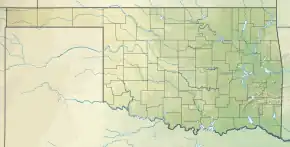
Watonga Lake is a reservoir in Blaine County, Oklahoma.[1] It is 7 miles (11 km) north of Watonga, Oklahoma. Constructed by the Oklahoma Department of Wildlife Conservation (ODWC) in 1955, is adjacent to Roman Nose State Park, with which it shares many recreational facilities.[2]
Etymology
The name Watonga was that of an Arapaho tribe leader (also given as woteen-kotuh'oo) meaning "black coyote."[3]
Description
The lake is small, compared to many of the other lakes and reservoirs in the state. The surface area is 55 acres (22 ha), the rated capacity is 656 acre-feet (809,000 m3), the shore line is 2.5 miles (4.0 km), average depth is 11.9 feet (3.6 m) and the maximum depth is 26 feet (7.9 m)[2] According to Map Carta, the lake elevation is 1,375 feet (419 m).[4]
References
- ↑ U.S. Geological Survey Geographic Names Information System: Watonga Lake
- 1 2 "Watonga". Oklahoma Department of Wildlife Conservation. 2019. Retrieved December 1, 2019.
- ↑ Bright, William (2013). Native American Placenames of the Southwest: A Handbook for Travelers. Norman: University of Oklahoma Press. p. 121. ISBN 978-0-8061-2444-5. Retrieved July 1, 2020.
- ↑ "Watonga Lake". Mapcarta. Retrieved December 1, 2019.
This article is issued from Wikipedia. The text is licensed under Creative Commons - Attribution - Sharealike. Additional terms may apply for the media files.