Waldeck | |
|---|---|
| Village of Waldeck | |
 Waldeck  Waldeck | |
| Coordinates: 50°21′29″N 107°35′49″W / 50.358°N 107.597°W | |
| Country | Canada |
| Province | Saskatchewan |
| Region | South-central |
| Census division | 7 |
| Rural Municipality | Excelsior No. 166 |
| Founded | 1882 |
| Post office Founded | 1906-10-01 |
| Incorporated (Village) | December 23, 1913 |
| Government | |
| • Type | Municipal |
| • Governing body | Waldeck Village Council |
| • Mayor | Russel Hildebrand |
| • Administrator | Sherry Kinney |
| Area | |
| • Total | 2.00 km2 (0.77 sq mi) |
| Population (2016) | |
| • Total | 297 |
| • Density | 148.3/km2 (384/sq mi) |
| Time zone | UTC-6 (CST) |
| Postal code | S0H 4J0 |
| Area code | 306 |
| Highways | |
| Railways | Canadian Pacific Railway |
| [1][2][3][4] | |
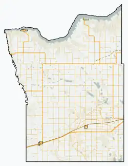
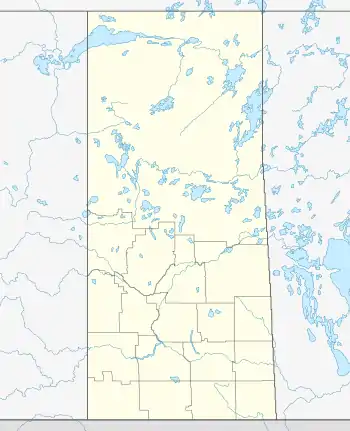
Waldeck (2016 population: 277) is a village in the Canadian province of Saskatchewan within the Rural Municipality of Excelsior No. 166 and Census Division No. 7. Waldeck is 18 kilometres (11 mi) northeast of the city of Swift Current on the Trans-Canada Highway. Waldeck is situated in the Swift Current River Valley.[5]
History
Waldeck is a German word meaning "Wooded Corner"; the community is probably named after the willows that grew along the banks of the Swift Current Creek. In 1903 the Canadian Government opened to settlement a tract of land from Swift Current Creek to Herbert. Among the first settlers were Rev. Klaas Peters and Mr. Abraham (probably Abram Klassen) in 1908. Waldeck incorporated as a village on December 23, 1913.[6]
The majority of the people in and around Waldeck are of Mennonite ancestry.
Elon Musk worked on a farm near Waldeck after coming to Canada from South Africa in the late 1980s.[7]
Demographics
In the 2021 Census of Population conducted by Statistics Canada, Waldeck had a population of 294 living in 114 of its 119 total private dwellings, a change of 6.1% from its 2016 population of 277. With a land area of 1.99 km2 (0.77 sq mi), it had a population density of 147.7/km2 (382.6/sq mi) in 2021.[10]
In the 2016 Census of Population, the Village of Waldeck recorded a population of 277 living in 113 of its 117 total private dwellings, a -7.2% change from its 2011 population of 297. With a land area of 2 km2 (0.77 sq mi), it had a population density of 138.5/km2 (358.7/sq mi) in 2016.[11]
See also
References
- ↑ National Archives, Archivia Net. "Post Offices and Postmasters". Retrieved 2014-08-21.
- ↑ Government of Saskatchewan, MRD Home. "Municipal Directory System". Retrieved 2014-08-21.
- ↑ Canadian Textiles Institute. (2005), CTI Determine your provincial constituency
- ↑ Commissioner of Canada Elections, Chief Electoral Officer of Canada (2005), Elections Canada On-line
- ↑ "Swift Current Creek Basin". VACEA. Retrieved 2014-08-21.
- ↑ "Urban Municipality Incorporations". Saskatchewan Ministry of Government Relations. Archived from the original on October 15, 2014. Retrieved June 1, 2020.
- ↑ Henry, Zoe. "The Scrappy Habit That Made Young Elon Musk a Successful Entrepreneur". Inc. Retrieved June 18, 2022.
- ↑ "Saskatchewan Census Population" (PDF). Saskatchewan Bureau of Statistics. Archived from the original (PDF) on September 24, 2015. Retrieved May 31, 2020.
- ↑ "Saskatchewan Census Population". Saskatchewan Bureau of Statistics. Retrieved May 31, 2020.
- ↑ "Population and dwelling counts: Canada, provinces and territories, census divisions and census subdivisions (municipalities), Saskatchewan". Statistics Canada. February 9, 2022. Retrieved April 1, 2022.
- ↑ "Population and dwelling counts, for Canada, provinces and territories, and census subdivisions (municipalities), 2016 and 2011 censuses – 100% data (Saskatchewan)". Statistics Canada. February 8, 2017. Retrieved May 30, 2020.
- The Bergthaler Mennonites by Klaas Peters. Translated from the German by Margaret Loewen Reimer. With a biography of Klaas Peters by Leonard Doell. CBMC Publications, Winnipeg, Manitoba, 1988.
