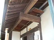
A wajū (輪中, lit. 'inside the circle') is a hydraulic engineering and flood control structure unique to the alluvial floodplain of the Kiso Three Rivers in central Japan.[1] It is comparable to the European polder or koog, although a wajū is typically not reclaimed. The hardships endured for centuries by farmers whose lives revolved around the wajū has given rise to the term "wajū spirit" (輪中根性, wajū konjō).
History
Since prehistoric times, sudden freshets in late spring caused by snowmelt in the Japanese Alps along the course of the major rivers of Owari and Mino created great suffering for agricultural communities. The wajū was developed to protect fertile riparian farmland from becoming submerged by rising water levels during these freshets.[1] Wajū are known to have been in use since at least the 16th century,[2] but some wajū are reputed to be much older, such as Takasu wajū which was allegedly completed in 1319.[3]
To develop a wajū, an area of land, usually a river island, was enclosed by a levee ring. In the event of a levee failure, most wajū incorporated structures allowing for vertical evacuation.
See also
- Ōgaki Castle, which is protected by a wajū
- Johannis de Rijke
- Tatsuta wajū sluice gates
- 1754 Hōreki River incident
References
- 1 2 "輪中の智恵を伝える リスクコミュニケーション 木曽三川の「輪中根性」を「水防文化」に昇華する". Mizkan Water Culture Center ミツカン水の文化センター. Retrieved 8 November 2023.
- ↑ Turnbull, Stephen (2000). The Samurai Sourcebook. London: Cassell & C0. p. 221. ISBN 1-85409-523-4.
- ↑ 青木 Aoki, 哲哉 Tetsuya (1989). 輪中の地形学的再検討 Wajū no chikeigakuteki saikentō. Japan. pp. 21–28. Retrieved 8 November 2023.
{{cite book}}: CS1 maint: location missing publisher (link)
Further reading
- Shinomoto, Etsuko. "Waju: Ethos for Water Use and Flood Control" (PDF). Nanzan University. Retrieved 27 November 2023.
.jpg.webp)