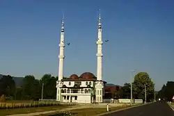
Vrbanjci
Врбањци | |
|---|---|
Village | |
 | |
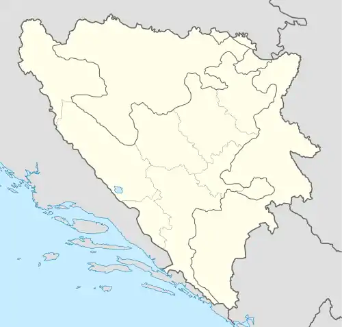
 Vrbanjci Location in Bosnia and Herzegovina | |
| Coordinates: 44°35′15″N 17°25′55″E / 44.58750°N 17.43194°E | |
| Country | Bosnia and Herzegovina |
| Entity | Republika Srpska |
| Municipality | Kotor Varoš |
Vrbànjci (Serbian Cyrillic: Врбањци) is a village in Bosnia and Herzegovina, Republika Srpska, in the Municipality of Kotor Varoš.
Geography
Vrbanjci lies along the Vrbanja river (after which it is named), between its tributaries Jezerka, Bosanka, and Cvrcka.[1][2][3] Vrbanjci was formerly known as Plitska. This name was given to the village when the largest part of the settlement was situated near Bosanka (Plitka Rika, Shallow River). On this toponym there is a neighboring village named Plitska, almost forgotten since its destruction in 1992.
The intensive colonization of the fields surrounding the Vrbanja river occurred during the construction of a narrow-rails railway and the regional road in the direction of Šiprage and Maslovare, i.e. Teslić to Doboj. Vrbanjci was once a separate municipality (to 1964th) in the former County of Kotor Varoš.
History
The history of this area commemorates the battle on The Field of Večići, approximately Mlâvâ locality, on the Vrbanja river, where was the clash between the Ottomans army and repressed pro Bosnian forces, from almost the entire State of Bosnia. Legend of there slayed brothers (shahids), who while dead carried their own heads is recounted until today. There is a turbeh, in the village of Večići in the memory. According to the historical context, it probably occurred around 1463, when Bosnia fell under Ottoman Administration.
During the World War II, this area was alternately ruled by partisans (the Third and Fourth Proletarian Brigade) and the German occupiers with the assistance of Ustasha and Chetniks. In the course of one such German occupation, all of inhabitants of Večići were arrested for the murder of two German soldiers 1942, for the murder of two German soldiers in the village of Staza, all of the inhabitants of Večići (village in Vrbanjci's local community) were arrested (1942). It is here also that toward end of the war, in the Partisans made preparations for the liberation of the Kotor Varoš. This town was one of the last strongholds of Ustasha and so called "home-defender"'s forces in Bosnia.[4][5]
During the last War in Bosnia (1992–1995), Serb paramilitary and police forces have committed crimes against the civilian population in Vrbanjci and surrounding villages.[6][7][8]
Most of the Bosniak population are back in their native lands and have restored their estates, with the assistance of the international community, but above all thanks to their own resources.
Since 1995, parents of Bosniak's pupils at the local Elementary school "Sveti Sava" have been running a lengthy court case to exercise their Constitutional right to teach in their native Bosnian language. Following a decade-long denial of the lawsuit at the Municipal Court in Kotor Varoš and the District Court in Banja Luka, the Constitutional Court of RS issued a verdict in their favor only in December 2019, obliging the defendant to reimburse all costs of the trial.[9][10][11]
Population
| Vrbanjci[12][13] | ||||||
| Census year | 1991 | 1981 | 1971 | |||
|---|---|---|---|---|---|---|
| Bosniaks | 1.468 (49.34%) | 487 (29.89%) | 514 (31.07%) | |||
| Croats | 799 (26.85%) | 689 (42.29%) | 651 (39.35%) | |||
| Serbs | 658 (22.11%) | 373 (22.89%) | 473 (28.59%) | |||
| Yugoslavians | 41 (1.37%) | 79 (4.84%) | 13 (0.78%) | |||
| Others and Unknown | 9 (0.30%) | 1 (0.06%) | 3 (0.18%) | |||
| Total | 2,975 | 1,629 | 1,654 | |||
Municipality populations of Kotor Varoš County, 1953
| Census area | Total | Serbs | Croats | Slovenians | Macedonians | Crnogorci | Yugoslavs undecided |
Czechs | Poljaci | Resins – Ukrainians |
Other Slavs | Other Non-Slavs |
| KOTOR VAROŠ COUNTY | 37898 | 25008 | 6485 | 4 | 4 | 10 | 6375 | 2 | – | 2 | – | 8 |
| Kotor Varoš | 4715 | 805 | 2640 | 2 | 3 | 6 | 1253 | 1 | – | 1 | – | 4 |
| Maslovare | 4574 | 3966 | 8 | – | – | – | 600 | – | – | – | – | – |
| Preville | 4576 | 3537 | 696 | – | – | – | 342 | – | – | – | – | 1 |
| Skender Vakuf | 7100 | 6566 | 16 | – | – | – | 518 | – | – | – | – | – |
| Šiprage | 7746 | 6036 | 24 | 1 | 1 | – | 1682 | – | – | – | – | 2 |
| Vrbanjci | 4919 | 1678 | 1728 | 1 | – | 4 | 1505 | 1 | – | 1 | – | 1 |
| Zabrđe | 4268 | 2420 | 1373 | – | – | – | 475 | – | – | – | – | – |
See also
References
- ↑ Vojnogeografski institut, Ed. (1955): Prnjavor (List karte 1:100.000, Izohipse na 20 m). Vojnogeografski institut, Beograd.
- ↑ Spahić M. et al. (2000): Bosnia and Herzegovina (1: 250 000). Publishing company "Sejtarija", Sarajevo.
- ↑ Mučibabić B., Ed. (1998): Geografski atlas Bosne i Hercegovine. Geodetski zavod BiH, Sarajevo, ISBN 9958-766-00-0.
- ↑ Petrić N., Ed. (1985): Opštine Kotor-Varoš i Skender-Vakuf u NOB-u 1941–1945. Radnički univerzitet "Đuro Pucar Stari", Kotor Varoš.
- ↑ Đondović R., Ed. (1989): Sanitetska služba u narodnooslobodilačkom ratu Jugoslavije 1941–1945, Knj. 2: Nastanak i razvoj sanitetske službe u oružanim snagama narodnooslobodilačkog pokreta u Bosni i Hercegovini, Crnoj Gori, Hrvatskoj i Makedoniji; Biblioteka Ratna prošlost naroda i narodnosti Jugoslavije, knj. 361. Monografija Jedinica NOV i PO Jugoslavije, Knj. 150). Vojnoizdavački i novinski centar, Sanitetska uprava SSNO, Beograd.
- ↑ Gutman R. (1993): A witness to genocide: The 1993 Pulitzer Prize-Winning Dispatches on the "Ethnic Cleansing" of Bosnia. Macmillan Publishing Company, Inc., New York, ISBN 9780020329954.
- ↑ Beč J. (1997): Pucanje duše. Samizdat B92, Beograd, ISBN 86-7208-010-6.
- ↑ "030527It". Archived from the original on 4 August 2012. Retrieved 22 December 2015.
- ↑ M. N. (2019): Presuđeno u korist bošnjačkih učenika – bosanski jezik se mora uvesti u školu u Vrbanjcima. Klix Accessdate, 5 December 2019.
- ↑ "Oslobođenje - (FOTO) Čekanje se isplatilo: Djeca iz Vrbanjaca se izborila za bosanski jezik!". 5 December 2019.
- ↑ "Roditelji zadovoljni presudom Vrhovnog suda RS". 5 December 2019.
- ↑ Book: "Nacionalni sastav stanovništva–Rezultati za Republiku po opštinama i naseljenim mjestima 1991", Statistički bilten br. 234, Izdanje Državnog zavoda za statistiku Republike Bosne i Hercegovine, Sarajevo.
- ↑ [Internet–Source, "Popis po mjesnim zajednicama"–http://www.fzs.ba/Podaci/nacion%20po%20mjesnim.pdf] Archived 5 October 2013 at the Wayback Machine
- ↑ "Data" (PDF). pod2.stat.gov.rs. Retrieved 15 November 2019.