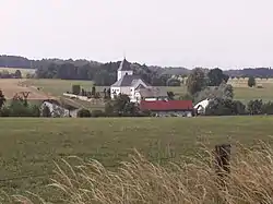
Velké Kunětice | |
|---|---|
 General view | |
 Flag  Coat of arms | |
 Velké Kunětice Location in the Czech Republic | |
| Coordinates: 50°19′0″N 17°15′58″E / 50.31667°N 17.26611°E | |
| Country | |
| Region | Olomouc |
| District | Jeseník |
| First mentioned | 1284 |
| Area | |
| • Total | 9.83 km2 (3.80 sq mi) |
| Elevation | 340 m (1,120 ft) |
| Population (2023-01-01)[1] | |
| • Total | 515 |
| • Density | 52/km2 (140/sq mi) |
| Time zone | UTC+1 (CET) |
| • Summer (DST) | UTC+2 (CEST) |
| Postal code | 790 52 |
| Website | www |
Velké Kunětice (German: Groß Kunzendorf) is a municipality and village in Jeseník District in the Olomouc Region of the Czech Republic. It has about 500 inhabitants. It lies on the border with Poland.
Velké Kunětice lies approximately 11 kilometres (7 mi) north-east of Jeseník, 81 km (50 mi) north of Olomouc, and 205 km (127 mi) east of Prague.
History
The first written mention of Velké Kunětice is from 1284, when it was owned by the Bishopric in Wrocław. At the end of the 15th century, there were limestone quarries and iron ore was probably mined in the area.[2]
From 1938 to 1945 it was occupied by Germany. During World War II, the Germans operated the E114 forced labour subcamp of the Stalag VIII-B/344 prisoner-of-war camp at the local stone quarry and factory.[3]
References
- ↑ "Population of Municipalities – 1 January 2023". Czech Statistical Office. 2023-05-23.
- ↑ "O obci" (in Czech). Obec Velké Kunětice. Retrieved 2022-01-28.
- ↑ "Working Parties". Lamsdorf.com. Archived from the original on 29 October 2020. Retrieved 13 November 2021.
External links