Valle di Cadore | |
|---|---|
| Comune di Valle di Cadore | |
 | |
Location of Valle di Cadore | |
 Valle di Cadore Location of Valle di Cadore in Italy  Valle di Cadore Valle di Cadore (Veneto) | |
| Coordinates: 46°25′N 12°20′E / 46.417°N 12.333°E | |
| Country | Italy |
| Region | Veneto |
| Province | Belluno (BL) |
| Frazioni | Suppiane, Vallesina, Venas di Cadore |
| Government | |
| • Mayor | Matteo Toscani |
| Area | |
| • Total | 41.3 km2 (15.9 sq mi) |
| Elevation | 851 m (2,792 ft) |
| Population (Dec. 2004)[2] | |
| • Total | 2,092 |
| • Density | 51/km2 (130/sq mi) |
| Demonym | Vallesani |
| Time zone | UTC+1 (CET) |
| • Summer (DST) | UTC+2 (CEST) |
| Postal code | 32040 |
| Dialing code | 0435 |
| Patron saint | St. Martin |
| Saint day | November 11 |

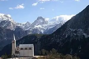
Parish Church with the mountains
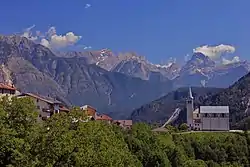
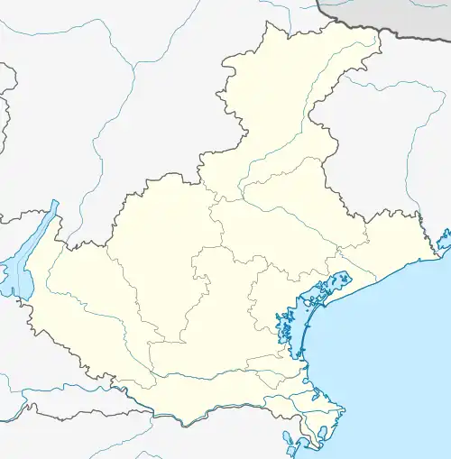
Valle di Cadore is a comune (municipality) in the province of Belluno in the Italian region of Veneto, located about 110 km (68 mi) north of Venice and about 35 km (22 mi) northeast of Belluno.
Valle is part of the Cadore Valley, not far from the Antelao peak, 3,264 metres (10,709 ft) above sea level. The main attraction is the Renaissance Palazzo Costantini Lanza.
History
Known simply as Valle until 1867, it was a castrum of the Romans, who also had a road built here to connect to the Via Claudia Augusta Altinate.
Titian, the painter, was born here around 1477.[3]
During the War of the League of Cambrai, in 1508, it was the seat of a battle of the Venetians and the Cadorines against the Habsburg Holy Roman Emperor Maximilian I.
International relations
Twin towns / Sister cities
References
- ↑ "Superficie di Comuni Province e Regioni italiane al 9 ottobre 2011". Italian National Institute of Statistics. Retrieved 16 March 2019.
- ↑ All demographics and other statistics: Italian statistical institute Istat.
- ↑ Chisholm, Hugh, ed. (1911). . Encyclopædia Britannica. Vol. 26 (11th ed.). Cambridge University Press. p. 1023.
This article is issued from Wikipedia. The text is licensed under Creative Commons - Attribution - Sharealike. Additional terms may apply for the media files.