Tukvar Tea Garden | |
|---|---|
Village | |
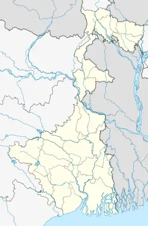
 Tukvar Tea Garden Location in West Bengal, India  Tukvar Tea Garden Tukvar Tea Garden (India) | |
| Coordinates: 27°05′46″N 88°15′27″E / 27.0962°N 88.2575°E | |
| Country | |
| State | West Bengal |
| District | Darjeeling |
| Population (2011) | |
| • Total | 4,791 |
| Time zone | UTC+5:30 (IST) |
| PIN | 734 104 |
| Lok Sabha constituency | Darjeeling |
| Vidhan Sabha constituency | Darjeeling |
| Website | darjeeling |
Tukvar Tea Garden is a village in the Darjeeling Pulbazar CD block in the Darjeeling Sadar subdivision of the Darjeeling district in the state of West Bengal, India.
Geography
CT: census town, R: rural/ urban centre, N: neighbourhood, H: hill centre, NP: national park/ wildlife sanctuary, TE: tea estate, TA: tourist attraction
Abbreviations used in names – TG for Tea Garden (town/village), TE for Tea Estate
Owing to space constraints in the small map, the actual locations in a larger map may vary slightly
Location
Tukvar Tea Garden is located at 27°05′46″N 88°15′27″E / 27.0962°N 88.2575°E.
Area overview
The map alongside shows the northern portion of the Darjeeling Himalayan hill region. Kangchenjunga, which rises with an elevation of 8,586 metres (28,169 ft) is located further north of the area shown.[1] Sandakphu, rising to a height of 3,665 metres (12,024 ft), on the Singalila Ridge, is the highest point in West Bengal.[2] In Darjeeling Sadar subdivision 61% of the total population lives in the rural areas and 39% of the population lives in the urban areas.[3][4] There are 78 tea gardens/ estates (the figure varies slightly according to different sources), producing and largely exporting Darjeeling tea in the district. It engages a large proportion of the population directly/ indirectly.[5] Some tea gardens were identified in the 2011 census as census towns or villages.[6] Such places are marked in the map as CT (census town) or R (rural/ urban centre). Specific tea estate pages are marked TE.
Note: The map alongside presents some of the notable locations in the subdivision. All places marked in the map are linked in the larger full screen map.
Demographics
According to the 2011 Census of India, Tukvar Tea Garden had a total population of 4,791 of which 2,339 (49%) were males and 2,452 (51%) were females. There were 397 persons in the age range of 0 to 6 years. The total number of literate people in Tukvar Tea Garden was 3,529 (73.66% of the population over 6 years).[7]
Tea estates
The management of Tukvar Tea Estate had issued an order for "suspension of work" after some workers had allegedly tried to beat up a manager. As of 2016, it remained closed.[8]
North Tukvar Tea Estate is one of the oldest tea gardens in Darjeeling. It started commercial production in 1856.[9]
Puttabong Tea Estate was formerly known as Tukvar Tea Estate.[10]
Vah Tukvar, an old and historical tea garden, fell on bad days and effectively closed down around 1995, although no formal announcement about its closure was made. The Chamong group acquired the abandoned Vah Tukvar, renamed it Shree Dwarika, and reopened its gates in 2006.[11]
Darjeeling Ropeway
Darjeeling Ropeway was started in 1968 from Singamari in Darjeeling. In 45 minutes, the ropeway transported passengers from a height of 7,000 ft down to 800 feet where the last station was located at Singla Bazar on the bank of the Rangeet. As of 2020, the ropeway runs only up to Tukvar.[12]
References
- ↑ Gurung, H. & Shrestha, R. K. (1994). Nepal Himalaya Inventory. Kathmandu: Ministry of Tourism and Civil Aviation.
- ↑ "Sandakphu-Phalut Trek". Himalayan High. Retrieved 21 March 2020.
- ↑ "Darjeeling". District Profile - General Information. District administration. Retrieved 21 March 2020.
- ↑ "District Statistical Handbook 2013 Darjeeling". Tables 2.2, 2.4b. Department of Planning and Statistics, Government of West Bengal. Retrieved 21 March 2020.
- ↑ "Darjeeling Tea". District administration. Retrieved 21 March 2020.
- ↑ "2011 Census – Primary Census Abstract Data Tables". West Bengal – District-wise. Registrar General and Census Commissioner, India. Retrieved 21 March 2020.
- ↑ "2011 Census – Primary Census Abstract Data Tables". West Bengal – District-wise. Registrar General and Census Commissioner, India. Retrieved 10 March 2020.
- ↑ Chhetri, Vivek. "Agitation threat over tea garden dues". The Telegraph, 5 January 2016. Retrieved 10 March 2020.
- ↑ "North Tukvar Tea Estate - Darjeeling". Darjeeling Tea Boutique. Retrieved 10 March 2020.
- ↑ "Puttabong (Tukvar) Tea Estate". Darjeeling Tea Boutique. Retrieved 10 March 2020.
- ↑ "Shree Dwarika Tea Estate". Chamong. Retrieved 10 March 2020.
- ↑ "Darjeeling Ropeway: Rangeet Valley Passenger Cable Car". Darjeeling Tourism. Retrieved 10 March 2020.