Tapauá | |
|---|---|
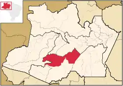
 Location of the municipality inside Amazonas | |
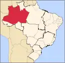
 Tapauá Location in Brazil | |
| Coordinates: 5°37′40″S 63°10′58″W / 5.62778°S 63.18278°W | |
| Country | |
| Region | North |
| State | |
| Area | |
| • Total | 89,324 km2 (34,488 sq mi) |
| Population (2020) | |
| • Total | 17,015 |
| • Density | 0.19/km2 (0.49/sq mi) |
| Time zone | UTC−4 (AMT) |
Tapauá is a municipality located in the Brazilian state of Amazonas. Its population was 17,015 (2020)[1] and its area is 89,324 km2,[2] making it the third largest municipality in Amazonas and the fifth largest in Brazil, comparable to South Carolina or Jordan.
Geography
Conservation
The municipality contains the 233,864 hectares (577,890 acres) Abufari Biological Reserve, a strictly protected area.[3] It contains 30.35% of the 1,008,167 hectares (2,491,230 acres) Piagaçu-Purus Sustainable Development Reserve, established in 2003.[4] The municipality contains about 9% of the Balata-Tufari National Forest, a 1,079,670 hectares (2,667,900 acres) sustainable use conservation unit created in 2005.[5] The municipality also contains about 94% of the Nascentes do Lago Jari National Park, an 812,745 hectares (2,008,340 acres) protected area established in 2008.[6] It contains 0.33% of the 604,209 hectares (1,493,030 acres) Médio Purus Extractive Reserve, created in 2008.[7] It contains 98% of the 881,704 hectares (2,178,740 acres) Tapauá State Forest, created in 2009.[8]
References
- ↑ IBGE 2020
- ↑ IBGE -
- ↑ Unidade de Conservação: Reserva Biológica do Abufari (in Portuguese), MMA: Ministério do Meio Ambiente, retrieved 2016-04-24
- ↑ RDS Piagaçu-Purus (in Portuguese), ISA: Instituto Socioambiental, retrieved 2016-08-20
- ↑ FLONA de Balata-Tufari (in Portuguese), ISA: Instituto Socioambiental, retrieved 2016-06-03
- ↑ FLONA do Iquiri (in Portuguese), ISA: Instituto Socioambiental, retrieved 2016-06-02
- ↑ RESEX Médio Purus (in Portuguese), ISA: Instituto Socioambiental, retrieved 2016-09-03
- ↑ FES Tapauá (in Portuguese), ISA: Instituto Socioambiental, retrieved 2016-09-02
