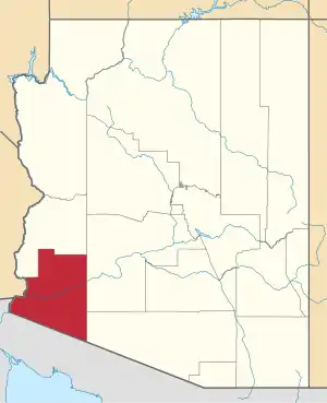
Stoval, Arizona | |
|---|---|
 Stoval Location within the state of Arizona  Stoval Stoval (the United States) | |
| Coordinates: 32°45′54″N 113°37′20″W / 32.76500°N 113.62222°W | |
| Country | United States |
| State | Arizona |
| County | Yuma |
| Elevation | 400 ft (122 m) |
| Time zone | UTC-7 (Mountain (MST)) |
| • Summer (DST) | UTC-7 (MST) |
| Area code | 928 |
| FIPS code | 04-69970 |
| GNIS feature ID | 24631 |
Stoval is a populated place situated in Yuma County, Arizona, United States, located approximately 70 miles east of Yuma.[2] Originally established as a stagecoach stop in 1869, named Grinnell Station after its first station master Henry Grinnell, it later served as a railroad station on the Southern Pacific Railroad's Sunset Route. Circa 1875 the name was changed to Texas Hill, after a group of emigrants from Texas who were supposedly killed in the area.[1] In 1882–83, Oscar F. Thornton emigrated from California and established a farming community near the station. Due to the fertility of the farmland, he named his community Christvale.[3] Thornton became the first postmaster of the Christvale post office when it was established on September 25, 1888.[1] Railroad personnel did not like the name, however, and shortened it to Chrystoval (or Crystoval). With the advent of the telegraph, the name was further shortened to its present-day Stoval in approximately 1911, in order to save on telegraphing. After closing down at some point, the post office was re-established on May 21, 1914, under the name of Stoval.[3] It has an estimated elevation of 400 feet (120 m) above sea level.[1]
References
- 1 2 3 4 "Feature Detail Report for: Stoval". Geographic Names Information System. United States Geological Survey, United States Department of the Interior.
- ↑ "Stoval (in Yuma County, AZ) Populated Place Profile". AZ Hometown Locator. Retrieved April 28, 2017.
- 1 2 Barnes, Will Croft (2016). Arizona Place Names. Tucson: University of Arizona Press. p. 427. ISBN 978-0816534951.
