Stokke | |
|---|---|
Village | |
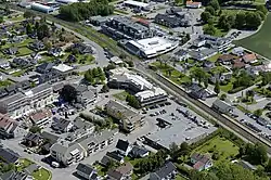 View of the village centre | |
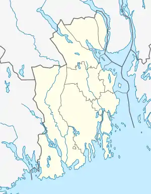 Stokke Location of the village  Stokke Stokke (Norway) | |
| Coordinates: 59°13′25″N 10°18′01″E / 59.22359°N 10.30032°E | |
| Country | Norway |
| Region | Eastern Norway |
| County | Vestfold |
| District | Vestfold |
| Municipality | Sandefjord Municipality |
| Area | |
| • Total | 2.31 km2 (0.89 sq mi) |
| Elevation | 58 m (190 ft) |
| Population (2022)[1] | |
| • Total | 4,221 |
| • Density | 1,827/km2 (4,730/sq mi) |
| Time zone | UTC+01:00 (CET) |
| • Summer (DST) | UTC+02:00 (CEST) |
| Post Code | 3160 Stokke |
Stokke is a village in Sandefjord Municipality in Vestfold county, Norway. The village is located about 10 kilometres (6.2 mi) to the northeast of the city of Sandefjord and about 10 kilometres (6.2 mi) to the southwest of the city of Tønsberg. The village of Melsomvik and the Tønsbergfjorden lie about 2 kilometres (1.2 mi) to the east of Stokke.[3]
The 2.31-square-kilometre (570-acre) village has a population (2022) of 4,221 and a population density of 1,827 inhabitants per square kilometre (4,730/sq mi).[1]
Stokke was the administrative centre of the old Stokke Municipality which existed from 1838 until its dissolution on 1 January 2017.[3]
The European route E18 highway passes 2 kilometres (1.2 mi) to the northwest of the village. The Vestfoldbanen railway line passes through the village, stopping at the Stokke Station. Stokke Church is located in the village. The village is the site of the Bokemoa elementary school and Stokke secondary school. The Gjennestad upper secondary school lies just a short distance north of the village.
Media gallery
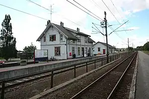
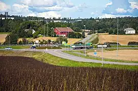 Highway interchange near Stokke
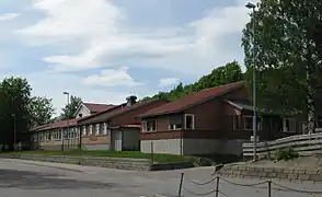 Bokemoa elementary school
 Stokke secondary school
References
- 1 2 3 Statistisk sentralbyrå (1 January 2022). "Urban settlements. Population and area, by municipality".
- ↑ "Stokke, Sandefjord". yr.no. Retrieved 16 November 2023.
- 1 2 Mæhlum, Lars, ed. (28 December 2022). "Stokke". Store norske leksikon (in Norwegian). Kunnskapsforlaget. Retrieved 16 November 2023.