Stitswerd | |
|---|---|
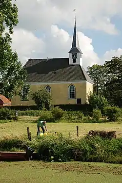
 The church of Stitswerd | |
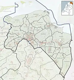
 Stitswerd Location of Stitswerd in the province of Groningen  Stitswerd Stitswerd (Netherlands) | |
| Coordinates: 53°21′40″N 6°35′57″E / 53.36111°N 6.59917°E | |
| Country | Netherlands |
| Province | Groningen |
| Municipality | Het Hogeland |
| Area | |
| • Total | 0.18 km2 (0.07 sq mi) |
| Elevation | 0.4 m (1.3 ft) |
| Population (2021)[1] | |
| • Total | 60 |
| • Density | 330/km2 (860/sq mi) |
| Postal code | 9999[1] |
| Dialing code | 0595 |
Stitswerd is a village in the municipality of Het Hogeland, Groningen, the Netherlands. It had a population of around 45 in January 2017.[3] Stitswerd is located on a wierde near the estuary of the former river Fivel.
Stitswerd has the highest postal code in the Netherlands (9999 XL).
History
The village was first mentioned in the second half of the 9th century as Stukisweret, and means "terp (artificial living hill) of Stukki (person)".[4]
The Dutch Reformed church dates from the 13th century and is located on the terp, however part of the terp has been excavated. The church is sometimes in service, but is also used for cultural activities.[5]
Stitswert was home to 209 people 1840. It was part of Kantens municipality before 1990, when it became part of Hefshuizen. In 2019, it became part of the municipality of Het Hogeland.[5]
Gallery
.jpg.webp) Farm in Stitswerd
Farm in Stitswerd Former pub
.jpg.webp) Harbour of Stitswerd
Harbour of Stitswerd
References
- 1 2 3 "Kerncijfers wijken en buurten 2021". Central Bureau of Statistics. Retrieved 8 April 2022.
- ↑ "Postcodetool for 9999XB". Actueel Hoogtebestand Nederland (in Dutch). Het Waterschapshuis. Retrieved 8 April 2022.
- ↑ Kerncijfers wijken en buurten 2017 - CSB Statline
- ↑ "Stitswerd - (geografische naam)". Etymologiebank (in Dutch). Retrieved 28 April 2022.
- 1 2 "Stitswerd". Plaatsengids (in Dutch). Retrieved 28 April 2022.
External links
 Media related to Stitswerd at Wikimedia Commons