Stepfershausen | |
|---|---|
 Coat of arms | |
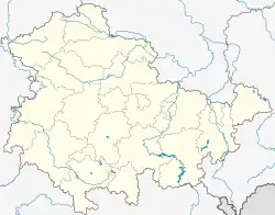
Location of Stepfershausen | |
 Stepfershausen  Stepfershausen | |
| Coordinates: 50°36′N 10°18′E / 50.600°N 10.300°E | |
| Country | Germany |
| State | Thuringia |
| District | Schmalkalden-Meiningen |
| Town | Meiningen |
| Area | |
| • Total | 15.76 km2 (6.08 sq mi) |
| Elevation | 430 m (1,410 ft) |
| Population (2018-12-31) | |
| • Total | 619 |
| • Density | 39/km2 (100/sq mi) |
| Time zone | UTC+01:00 (CET) |
| • Summer (DST) | UTC+02:00 (CEST) |
| Postal codes | 98617 |
| Dialling codes | 036943 |
Stepfershausen is a village and a former municipality in the district Schmalkalden-Meiningen, in Thuringia, Germany. Since December 2019, it is part of the town Meiningen.
Stepfershausen is situated to the northeast of the Gebaberg, near the Thuringian Forest and the Dolmar mountain. According to the official website of the town Meiningen, the district has around 670 inhabitants.[1]
References
- ↑ "Stepfershausen". Stadt Meiningen (in German). Retrieved 2023-10-26.
This article is issued from Wikipedia. The text is licensed under Creative Commons - Attribution - Sharealike. Additional terms may apply for the media files.