| Sierra de Morones | |
|---|---|
| Sierra Morones | |
 | |
| Geography | |
| Country | Mexico |
| State | Zacatecas |
| terrestrial ecoregion | Sierra Madre Occidental pine–oak forests |
| Parent range | Sierra Madre Occidental |
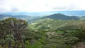
The Sierra de Morones is a mountain range in west-central Mexico.
Geography
The Sierra de Morones extends north and south through the state of Zacatecas. The Sierra, together with the Sierra Fría to the east and the Sierra los Huicholes to the west, forms the southern end of the Sierra Madre Occidental.
The Juchipila River drains the eastern slopes of the Sierra, running southwards to empty into the Río Grande de Santiago. The Bolaños River, another tributary of the Río Grande de Santiago, drains the western slope of the Sierra. The Río Grande de Santiago bounds the range on the south and southeast.
Flora and fauna
The Sierra de Morones is covered with pine–oak forests above 800 meters elevation. Oaks are the predominant trees, with pines becoming more common at higher elevation. Tropical dry forest occurs below 800 meters elevation.[1]
Pinus maximartinezii is a species of pine tree found only in the Sierra de Morones, occurring between 1,600 and 2,000 meters elevation.[1]
Conservation
Part of the Sierra is in Cuenca Alimentadora del Distrito Nacional de Riego 043 Estado de Nayarit, a national natural resources protection area. It was established in 1949 to protect forests and watersheds for the benefit of downstream agriculture, and was redesignated a national resources protection area in 2002.[2]
References
- 1 2 Sierra de Morones. Regiones Terrestres Prioritarias de México, CONABIO. Accessed 23 October 2021.
- ↑ "CADNR 043 Estado de Nayarit". Sistema de Información, Monitoreo y Evaluación para la Conservación (SIMEC) of the Comisión Nacional de Áreas Naturales Protegidas (CONANP). Accessed 23 October 2021.