| Shohimardonsoy Шаймерден / Shaymerden | |
|---|---|
 | |
| Location | |
| Country | Kyrgyzstan, Uzbekistan |
| Physical characteristics | |
| Source | Alay Range |
| Mouth | Great Fergana Canal |
• coordinates | 40°29′18″N 71°37′00″E / 40.4882°N 71.6168°E |
| Length | 112 km (70 mi) |
| Basin size | 1,467 km2 (566 sq mi) |
| Discharge | |
| • average | 10.1 m3/s (360 cu ft/s) |
| Basin features | |
| Progression | Great Fergana Canal→ Syr Darya→ North Aral Sea |
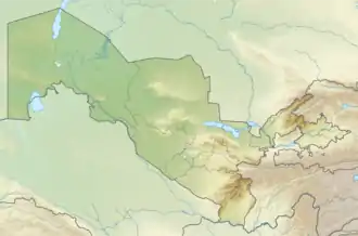
The Shohimardonsoy (Uzbek: Shohimardonsoy,[1] Kyrgyz: Шаймерден, romanized: Shaymerden[2]) is a river in Kyrgyzstan and Uzbekistan. It is formed at the confluence of the rivers Aksuu and Köksuu, that run from the Alay Range, near the village Shohimardon. Its lower course, between Vodil and the city Fergana, is known as Margʻilonsoy.[1] It discharges into the Great Fergana Canal near Margilan. The river is 112 km (70 mi) long, and the watershed covers 1,467 km2 (566 sq mi).[2] The main settlements along the river Shohimardonsoy are the cities Margilan, Fergana and Kadamjay, and the town Vodil.[2] Its annual average flow rate is 10.1 m3/s (360 cu ft/s).[1]
References
- 1 2 3 "Шоҳимардонсой" [Shohimardonsoy] (PDF). National Encyclopedia of Uzbekistan (in Uzbek). Tashkent. 2000–2005. p. 215.
{{cite encyclopedia}}: CS1 maint: location missing publisher (link) - 1 2 3 "Шаймерден" [Shaymerden] (PDF). Кыргызстандын Географиясы [Geography of Kyrgyzstan] (in Kyrgyz). Bishkek. 2004. p. 214.
{{cite encyclopedia}}: CS1 maint: location missing publisher (link)
This article is issued from Wikipedia. The text is licensed under Creative Commons - Attribution - Sharealike. Additional terms may apply for the media files.