Schnals | |
|---|---|
| Gemeinde Schnals Comune di Senales | |
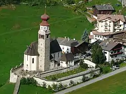
 Church of the Assumption of Virgin Mary | |
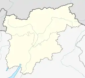
Location of Schnals | |
 Schnals Location of Schnals in Italy  Schnals Schnals (Trentino-Alto Adige/Südtirol) | |
| Coordinates: 46°42′N 10°55′E / 46.700°N 10.917°E | |
| Country | Italy |
| Region | Trentino-Alto Adige/Südtirol |
| Province | South Tyrol (BZ) |
| Frazioni | Karthaus (Certosa), Katharinaberg (Monte Santa Caterina), Unser Frau (Madonna) |
| Government | |
| • Mayor | Karl Josef Rainer (SVP) |
| Area | |
| • Total | 211.2 km2 (81.5 sq mi) |
| Population (Nov. 2010)[2] | |
| • Total | 1,345 |
| • Density | 6.4/km2 (16/sq mi) |
| Demonym(s) | German: Schnalser Italian: senalesini |
| Time zone | UTC+1 (CET) |
| • Summer (DST) | UTC+2 (CEST) |
| Postal code | 39020 |
| Dialing code | 0473 |
| Website | Official website |
Schnals (German pronunciation: [ʃnals]; Italian: Senales [seˈnaːles]) is a comune (municipality) in the autonomous province of South Tyrol in northern Italy, located about 40 kilometres (25 mi) northwest of the city of Bolzano, on the border with Austria. The municipality includes large parts of the Schnalstal.
Geography
As of 30 November 2010, it had a population of 1,345 and an area of 211.2 square kilometres (81.5 sq mi).[3]
Schnals borders the following municipalities: Kastelbell-Tschars, Latsch, Mals, Moos in Passeier, Naturns, Partschins, Schlanders, and Sölden (Austria).
Frazioni
The municipality of Schnals contains the frazioni (subdivisions, mainly villages and hamlets) Karthaus (Certosa), and Katharinaberg (Monte Santa Caterina), Unser Frau (Madonna).
History
Coat-of-arms
The shield is azure and argent party per pale. The first part represents Gabriel of or with a sword in his right hand over the head, and a scales in the left, standing on a sable dragon with a gules tongue. Three azure gyrons, with the point on the division, are in the second part. The shield represents the patron saint of the Carthusian Abbey of Allerengelberg and the arms of the Lords of Schandersberg. The emblem was adopted in 1967.[4]
Society
Linguistic distribution
According to the 2011 census, 98.24% of the population speak German and 1.76% Italian as first language.[5]
Demographic evolution

Images
 The Finailhöfe - leftmost snow-capped mountain is the Similaun. Out of sight to the left is the Fineilspitze, on which ridge Ötzi the Iceman was found.
 Village Church Unser Frau
References
- ↑ "Superficie di Comuni Province e Regioni italiane al 9 ottobre 2011". Italian National Institute of Statistics. Retrieved 16 March 2019.
- ↑ "Popolazione Residente al 1° Gennaio 2018". Italian National Institute of Statistics. Retrieved 16 March 2019.
- ↑ All demographics and other statistics: Italian statistical institute Istat.
- ↑ Heraldry of the World: Schnals
- ↑ "Volkszählung 2011/Censimento della popolazione 2011". astat info. Provincial Statistics Institute of the Autonomous Province of South Tyrol (38): 6–7. June 2012. Retrieved 2012-06-14.
External links
- Tourismboard Val Senales - Schnals Valley
- (in German and Italian) Homepage of the municipality
![]() Media related to Schnals at Wikimedia Commons
Media related to Schnals at Wikimedia Commons
