Sandpoint, Idaho
kamanqukuⱡ | |
|---|---|
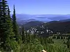
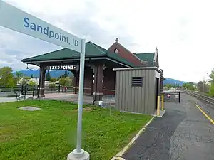
    Top row: Cedar Street Bridge Public Market; 2nd row: Sandpoint from Schweitzer Mountain; City Beach; 3rd row: Sandpoint Amtrak Station; Downtown Sandpoint | |
 Location of Sandpoint in Bonner County, Idaho. | |
| Coordinates: 48°16′N 116°34′W / 48.267°N 116.567°W | |
| Country | United States |
| State | Idaho |
| County | Bonner |
| Incorporation | 1898 |
| Area | |
| • Total | 4.56 sq mi (11.81 km2) |
| • Land | 4.26 sq mi (11.05 km2) |
| • Water | 0.30 sq mi (0.77 km2) |
| Elevation | 2,096 ft (639 m) |
| Population | |
| • Total | 8,639 |
| • Density | 2,094.02/sq mi (808.46/km2) |
| Demonym | Sandpointer |
| Time zone | UTC-8 (Pacific (PST)) |
| • Summer (DST) | UTC-7 (PDT) |
| ZIP Code | 83864 |
| Area code(s) | 208, 986 |
| FIPS code | 16-72100 |
| GNIS feature ID | 0398095 |
| Website | www |
Sandpoint (Kutenai language: kamanqukuⱡ[3]) is the largest city in, and the county seat of, Bonner County, Idaho, United States.[4] Its population was 8,639 at the 2020 census.
Sandpoint's major economic contributors include forest products, light manufacturing, tourism, recreation and government services. As the largest service center in the two northern Idaho counties (Bonner and Boundary), as well as northwestern Montana, it has an active retail sector.
Sandpoint lies on the shores of Idaho's largest lake, 43-mile-long Lake Pend Oreille, and is surrounded by three major mountain ranges, the Selkirk, Cabinet and Bitterroot ranges. It is home to Schweitzer Mountain Resort, Idaho's largest ski resort, and is on the International Selkirk Loop and two National Scenic Byways (Wild Horse Trail and Pend Oreille Scenic Byway). Among other distinctions awarded by national media in the past decade, in 2011 Sandpoint was named the nation's "Most Beautiful Small Town" by Rand McNally and USA Today.[5]
History
.jpg.webp)
Salish Tribes, specifically the Kalispel, and the Kootenai, built encampments on the shore of Lake Pend Oreille every summer, fished, made baskets of cedar, and collected huckleberries before returning to either Montana or Washington in the fall. The encampments ended before 1930.[6]
The region was extensively explored by David Thompson of the North West Company starting in 1807. Disputed joint British/American occupation of the Columbia District led to the Oregon boundary dispute. This controversy ended in 1846 with the signing of the Oregon Treaty, whereby Britain ceded all rights to land south of the 49th parallel.
In the 1880s, the Northern Pacific Railroad brought European and Chinese settlement to the area.
In August 1888, 29-year-old author and civil servant Theodore Roosevelt visited Sandpoint on a caribou-hunting trip in the Selkirk Mountains.[7] Roosevelt documented what a rough-and-tumble environment "Sand Point" was at that time (and for many decades following).
Sandpoint was officially incorporated in 1898.
Timber harvesting and railroads drove the economy for nearly a century as loggers moved in from the over-harvested Great Lakes region. Several lumber companies operated in the region from as early as 1896 to present, the most notable being the Humbird Lumber Company which operated from 1900 to around 1944. The lumber companies bought land from the Northern Pacific Railroad and built a major mill at Sandpoint and adjacent Kootenai. Lumber company-owned railroads extended into many of the local drainages including Grouse Creek, Gold Creek and Rapid Lightning Creek. Although the trees were never exhausted in the area, Humbird Lumber succumbed to the low timber prices of the Great Depression.
"Stump ranches" were sold by Humbird to many families who slowly cleared much of the valley land of tree stumps. Farming and ranching became the third largest business in the area, behind lumber and railroads, prior to the "discovery" of Lake Pend Oreille as a sports fishery in the 1950s. The economy was given a boost during World War II from Farragut Naval Station, a training center for the US Navy located at the southwestern end of Lake Pend Oreille.
The opening of Schweitzer Mountain Resort in 1963 turned the area into a year-round tourism destination. The beauty of the surrounding Selkirk and Cabinet Mountains and Lake Pend Oreille has kept Sandpoint a tourist favorite for water sports, hunting, hiking, horseback riding, fishing and skiing.
In the 1980s and 1990s, 30 miles south of Sandpoint, the areas of Coeur d'Alene and Hayden Lake attracted nationwide publicity when white supremacist Neo-Nazi groups (most notably the Aryan Nations) set up headquarters in the area. Many Sandpoint residents reacted negatively to such groups; some formed the Bonner County Human Rights Task Force in opposition. In 2001, the Aryan Nations lost a lawsuit filed against them.[8] The lawsuit bankrupted the organization and forced them to give up their Hayden Lake property and disband.[9] In December 2011, Sandpoint became the first city in Idaho to pass an ordinance prohibiting discrimination in housing, employment and public accommodations based on sexual orientation or gender identity.
Community organizations stage a number of regionally known annual events, including Sandpoint Winter Carnival in February; the Lost in the 50s vintage car show in May; and the Festival at Sandpoint summer music festival in August. Sandpoint's historic vaudeville-era Panida Theater hosts frequent performing art events and an ongoing independent film series. The Music Conservatory of Sandpoint provides classical music classes and inaugurated its "Little Carnegie" concert hall in 2022.[10] A robust visual arts community supported by the Pend Oreille Arts Council also contributes to Sandpoint's reputation as a center for arts and culture in northern Idaho and the Inland Northwest.
Geography and climate
| Sandpoint, Idaho | ||||||||||||||||||||||||||||||||||||||||||||||||||||||||||||
|---|---|---|---|---|---|---|---|---|---|---|---|---|---|---|---|---|---|---|---|---|---|---|---|---|---|---|---|---|---|---|---|---|---|---|---|---|---|---|---|---|---|---|---|---|---|---|---|---|---|---|---|---|---|---|---|---|---|---|---|---|
| Climate chart (explanation) | ||||||||||||||||||||||||||||||||||||||||||||||||||||||||||||
| ||||||||||||||||||||||||||||||||||||||||||||||||||||||||||||
| ||||||||||||||||||||||||||||||||||||||||||||||||||||||||||||

According to the United States Census Bureau, the city has a total area of 4.79 square miles (12.41 km2), of which 3.98 square miles (10.31 km2) is land and 0.81 square miles (2.10 km2) is water.[11]
Sandpoint has a fairly typical inland Northwestern humid continental climate (Köppen Dsb), with cold, snowy winters and dry summers with large diurnal temperature swings from hot in the day to very cool at night. The record low was −37 °F (−38 °C) on December 30, 1968, while the record high was 104 °F (40 °C) recorded on both July 20, 1923 and July 24, 1994. The wettest month was December 1933 with 11.99 inches (304.5 mm) of total precipitation and the most monthly snowfall 68.8 inches (174.8 cm) in January 1969.
| Climate data for Sandpoint, Idaho (Sandpoint Experiment Station) (1991–2020 normals, extremes 1910–present) | |||||||||||||
|---|---|---|---|---|---|---|---|---|---|---|---|---|---|
| Month | Jan | Feb | Mar | Apr | May | Jun | Jul | Aug | Sep | Oct | Nov | Dec | Year |
| Record high °F (°C) | 54 (12) |
61 (16) |
71 (22) |
87 (31) |
97 (36) |
106 (41) |
105 (41) |
102 (39) |
96 (36) |
81 (27) |
66 (19) |
58 (14) |
106 (41) |
| Mean daily maximum °F (°C) | 33.6 (0.9) |
38.4 (3.6) |
46.4 (8.0) |
55.6 (13.1) |
65.8 (18.8) |
71.8 (22.1) |
81.8 (27.7) |
81.9 (27.7) |
71.7 (22.1) |
56.3 (13.5) |
41.8 (5.4) |
33.5 (0.8) |
56.6 (13.7) |
| Daily mean °F (°C) | 28.3 (−2.1) |
31.1 (−0.5) |
37.5 (3.1) |
45.0 (7.2) |
53.8 (12.1) |
59.6 (15.3) |
66.7 (19.3) |
65.9 (18.8) |
57.0 (13.9) |
45.2 (7.3) |
35.3 (1.8) |
28.1 (−2.2) |
46.1 (7.8) |
| Mean daily minimum °F (°C) | 22.9 (−5.1) |
23.7 (−4.6) |
28.6 (−1.9) |
34.5 (1.4) |
41.8 (5.4) |
47.5 (8.6) |
51.6 (10.9) |
49.8 (9.9) |
42.4 (5.8) |
34.1 (1.2) |
28.9 (−1.7) |
22.8 (−5.1) |
35.7 (2.1) |
| Record low °F (°C) | −31 (−35) |
−31 (−35) |
−10 (−23) |
9 (−13) |
22 (−6) |
28 (−2) |
33 (1) |
28 (−2) |
16 (−9) |
4 (−16) |
−10 (−23) |
−37 (−38) |
−37 (−38) |
| Average precipitation inches (mm) | 4.33 (110) |
2.91 (74) |
3.58 (91) |
2.37 (60) |
2.72 (69) |
2.44 (62) |
1.17 (30) |
0.80 (20) |
1.41 (36) |
2.95 (75) |
4.72 (120) |
4.61 (117) |
34.01 (864) |
| Average snowfall inches (cm) | 20.9 (53) |
8.4 (21) |
6.5 (17) |
0.5 (1.3) |
0.0 (0.0) |
0.0 (0.0) |
0.0 (0.0) |
0.0 (0.0) |
0.0 (0.0) |
0.0 (0.0) |
6.4 (16) |
19.3 (49) |
62.0 (157) |
| Average precipitation days (≥ 0.01 in) | 15.8 | 12.3 | 13.6 | 11.6 | 11.3 | 10.8 | 5.5 | 4.7 | 7.3 | 11.3 | 14.2 | 15.2 | 133.6 |
| Average snowy days (≥ 0.1 in) | 9.2 | 5.0 | 3.9 | 0.6 | 0.0 | 0.0 | 0.0 | 0.0 | 0.0 | 0.1 | 3.3 | 9.3 | 31.4 |
| Source: NOAA[12][13] | |||||||||||||
Demographics
| Census | Pop. | Note | %± |
|---|---|---|---|
| 1910 | 2,993 | — | |
| 1920 | 2,876 | −3.9% | |
| 1930 | 3,290 | 14.4% | |
| 1940 | 4,356 | 32.4% | |
| 1950 | 4,265 | −2.1% | |
| 1960 | 4,355 | 2.1% | |
| 1970 | 4,144 | −4.8% | |
| 1980 | 4,460 | 7.6% | |
| 1990 | 5,203 | 16.7% | |
| 2000 | 6,835 | 31.4% | |
| 2010 | 7,365 | 7.8% | |
| 2020 | 8,639 | 17.3% | |
| U.S. Decennial Census[14] 2020[2] | |||
The median income between 2016 and 2020 for a household in the city was $46,712. The per capita income for the city was $28,210. The percentage of persons below the poverty line (2016–2020) was 14.7%.
The median value of owner-occupied housing in the city was $228,800. The homeownership rate (2006–2010) was 49.6%.
Of the population over 25 years of age (2006–2010), 89.9% had graduated high school, 25.6% had achieved a bachelor's degree or higher.
2010 census
As of the census[15] of 2010, there were 7,365 people, 3,215 households, and 1,811 families residing in the city. The population density was 1,850.5 inhabitants per square mile (714.5/km2). There were 3,769 housing units at an average density of 947.0 per square mile (365.6/km2). The racial makeup of the city was 95.5% White, 0.1% African American, 0.7% Native American, 0.8% Asian, 0.5% from other races, and 2.2% from two or more races. Hispanic or Latino of any race were 2.9% of the population.
There were 3,215 households, of which 29.3% had children under the age of 18 living with them, 39.4% were married couples living together, 12.3% had a female householder with no husband present, 4.7% had a male householder with no wife present, and 43.7% were non-families. 36.3% of all households were made up of individuals, and 15.1% had someone living alone who was 65 years of age or older. The average household size was 2.20 and the average family size was 2.86.
The median age in the city was 38.8 years. 23.3% of residents were under the age of 18; 8.1% were between the ages of 18 and 24; 26.2% were from 25 to 44; 25.9% were from 45 to 64; and 16.7% were 65 years of age or older. The gender makeup of the city was 48.2% male and 51.8% female.
Politics
| Year | Republican | Democratic | Third parties |
|---|---|---|---|
| 2020 | 47.1% 2148 | 49.9% 2275 | 3% 138 |
| 2016 | 44.7% 1646 | 44.3% 1630 | 11% 406 |
| Year | Republican | Democratic | Third parties |
|---|---|---|---|
| 2020 Senate | 46.8% 2113 | 49.8% 2248 | 3.4% 155 |
| 2018 Governor | 40.2% 1340 | 57.8% 1925 | 2% 65 |
| 2018 Lt. Governor | 41.9% 1365 | 58.1% 1890 | 0% 0 |
| 2018 Attorney General | 45.5% 1461 | 54.5% 1750 | 0% 0 |
| 2016 Senate | 51.2% 1863 | 44.5% 1619 | 4.2% 154 |

Economy
Since 2002, Sandpoint has been home to aircraft manufacturer Quest Aircraft.[17]
Education

Sandpoint is part of the Lake Pend Oreille School District. Sandpoint High School and Lake Pend Oreille Alternative High School educate students in grades 9 through 12.
Forrest Bird Charter School educates grades 6–12. History - First school in Sand Point all grades whose teacher was, Mary Murphy, wife of homesteader Thomas Murphy whose spring was used by the state fish hatchery for its water supply on opposite side of the lake. Property passed to Mary and then three of four sons, Leo, Ernest, and Arthur (who later became state senator and leader of the Democratic Party until 1977), oldest son, Charles (later a county commissioner) who had a nearby homestead. Arthur retained spring on his property. On Arthur's death the property and spring passed to Terrence Murphy, Arthur's youngest son.
Rail transportation

The Sandpoint Amtrak station serves as the only stop in Idaho. The Amtrak Empire Builder route carries passengers daily [18] in both directions between Chicago, Illinois to the east and Seattle, Washington and Portland, Oregon to the west.
Local media
- Radio
- KSPT AM 1400 (News/Talk)
- KRFY FM 88.5 (Alternative)
- KPND FM 95.3 (Adult Hits)
- KTAQ-LP FM 97.7 (3ABN Radio)
- KIBR FM 102.5 (Country music)
- KTPO FM 106.7 (KPND 95.3 repeater)
- FM 105.3 (Sandpoint's Hit Music)
- Television
Television stations serving Sandpoint originate from the Spokane, Washington market:
- The Bonner County Daily Bee, daily paper since 1965
- The Sandpoint Reader, weekly paper since 2004
Notable people
- Forrest Bird, aviator, biomedical inventor, recipient of Presidential Citizens Medal
- Allie Brosh, humorist blogger and novelist
- Leon Cadore, baseball pitcher who pitched a 26-inning game in 1920, graduate of Sandpoint High School
- John Craigie, folk singer, lived there for a summer and wrote the song "All of July" about Sandpoint[19]
- James C. Fry, United States Army major general, recipient of Distinguished Service Cross
- Mark Fuhrman, former LAPD detective primarily known for his role in the O. J. Simpson murder case
- Tinker Hatfield, athletic shoe designer and Nike Air Jordan architect
- Nate Holland, two-time Olympian, five-time X Games gold medalist, US Snowboard team
- Nell Kruegel Irion, city councilor and first woman to run for Congress in Idaho
- Jerry Kramer, National Football League right guard, author[20]
- Joe Mather, Major League Baseball outfielder
- Patrick F. McManus, outdoor writer and humorist
- Viggo Mortensen, actor and producer[21]
- Don Osborn, former minor league baseball pitcher and manager and pitching coach for the Pittsburgh Pirates
- Kristy Osmunson, singer and fiddle player of the country music duo Bomshel
- Sarah Palin, former governor of Alaska and 2008 Republican nominee for Vice President
- Genevieve Pezet (1913–2009), American artist who lived in France.[22]
- Jake Plummer, former NFL quarterback
- Shook Twins, folk music duo who grew up in Sandpoint
- Lucy Ann Polk, big-band singer
- Marilynne Robinson, writer and winner of the 2005 Pulitzer Prize for Fiction
- Jake Rosholt, mixed martial artist and former collegiate wrestler at Oklahoma State
- Don Samuelson, 25th Governor of Idaho (1967−1971)
- Edgar Steele, attorney found guilty of a murder-for-hire plot (from the nearby town of Sagle)
- Ben Stein, writer, lawyer, actor, comedian, and commentator on political and economic issues
- Tim Thomas, retired National Hockey League goaltender
References
- ↑ "2019 U.S. Gazetteer Files". United States Census Bureau. Retrieved July 9, 2020.
- 1 2 "2020 Census Data". data.census.gov.
- ↑ "Ktunaxa Nation Official Website - Territory Map".
- ↑ "Find a County". National Association of Counties. Retrieved June 7, 2011.
- ↑ Bly, Laura (July 22, 2011). "The five best small towns in America". USA Today. Archived from the original on January 12, 2012. Retrieved September 17, 2011.
- ↑ Green, Bob. "History of Sandpoint, Idaho - Remembering The Indians". sandpoint.com. Archived from the original on June 28, 2010. Retrieved June 8, 2010.
- ↑ Gunter, Bob. "History of Sandpoint, Idaho - Teddy Roosevelt in Early Sandpoint". sandpoint.com. Retrieved June 8, 2010.
- ↑ "Attorney Morris Dees pioneer in using 'damage litigation' to fight hate groups". CNN. September 8, 2000. Archived from the original on October 8, 2007. Retrieved August 17, 2007.
- ↑ "Keenan v. Aryan Nations". Southern Poverty Law Center. 2000. Archived from the original on July 13, 2007. Retrieved August 17, 2007.
- ↑ Compton, Sandy. "Entertainment is back ... with a vengeance". Sandpoint Magazine. Retrieved February 14, 2023.
- ↑ "US Gazetteer files 2010". United States Census Bureau. Archived from the original on January 25, 2012. Retrieved December 18, 2012.
- ↑ "NOWData - NOAA Online Weather Data". National Oceanic and Atmospheric Administration. Retrieved December 13, 2023.
- ↑ "Summary of Monthly Normals 1991-2020". National Oceanic and Atmospheric Administration. Retrieved December 13, 2023.
- ↑ "Census of Population and Housing". Census.gov. Retrieved June 4, 2015.
- ↑ "U.S. Census website". United States Census Bureau. Retrieved December 18, 2012.
- 1 2 "Dave's Redistricting". davesredistricting.org. Retrieved July 7, 2021.
- ↑ "Quest Aircraft Company". Quest Aircraft Company. Retrieved June 8, 2010.
- ↑ amtrak.com
- ↑ "John Craigie's New Album "October is The Kindest Month" is a Work of Art from Beginning To End". Jambandfriendly. October 11, 2011.
- ↑ Keyes, David (Winter 2019). "Kramer finally gets the call". SandpointMagazine.com. Keokee Co. Publishing, Inc. Retrieved January 16, 2023.
- ↑ Olson, Ben (January 13, 2017). "A Reader interview with Viggo Mortensen". SandpointReader.com. The Sanpoint Reader. Retrieved January 24, 2018.
- ↑ Genevieve pseudonym of Pezet, Genevieve; maiden name: White. Oxford University Press. 2011. doi:10.1093/benz/9780199773787.article.b00072263.
{{cite book}}:|work=ignored (help)
Further reading
- Pietsch, Gary L. (2019). Sandpoint's Early History: A story of how pioneers carved this city out of the wilderness. Sandpoint, ID: Keokee Co. Publishing. ISBN 978-1697677539.
- Edward S. Curtis, The North American Indian, Northwestern University, Digital Library Collections, "Kalispel", Page 51