San Pedro, Laguna | |||||||||||
|---|---|---|---|---|---|---|---|---|---|---|---|
.jpg.webp) San Pedro, Laguna Station in 2023 | |||||||||||
| General information | |||||||||||
| Location | G. Garcia Street, San Vicente San Pedro, Laguna Philippines | ||||||||||
| Coordinates | 14°21′42″N 121°03′19″E / 14.36167°N 121.05528°E | ||||||||||
| Owned by | Philippine National Railways | ||||||||||
| Operated by | Philippine National Railways | ||||||||||
| Line(s) | South Main Line Planned: South Commuter Former: Carmona | ||||||||||
| Platforms | Side platforms | ||||||||||
| Tracks | 3 | ||||||||||
| Connections | Jeepneys, buses, tricycles | ||||||||||
| Construction | |||||||||||
| Structure type | At grade | ||||||||||
| Other information | |||||||||||
| Station code | SPL | ||||||||||
| History | |||||||||||
| Opened | August 1, 1908 (original) December 23, 2013 (new) October 5, 2016 (with commuter services) | ||||||||||
| Rebuilt | 2015 | ||||||||||
| Previous names | San Pedro Tunasan | ||||||||||
| Services | |||||||||||
| |||||||||||
| Location | |||||||||||
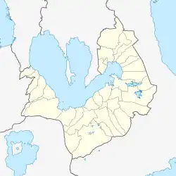
 San Pedro, Laguna Location within Laguna .svg.png.webp) San Pedro, Laguna San Pedro, Laguna (Luzon) .svg.png.webp) San Pedro, Laguna San Pedro, Laguna (Philippines) | |||||||||||
PNR Metro Commuter | |||||||||||||||||||||||||||||||||||||||||||||||||||||||||||||||||||||||||||||||||||||||||||||||||||||||||||||||||||||||||||||||||||||||||||||||||||||||||||||||||||||||||||||||||||||||||||||||||||||||||||||||||||||||||||||||||||||||||||||||||||||||||||||||||||||||||||||||||||||||||||||||||||||||||||||||||||||||||||||||||||||||||||||||||||||||||||||||||||||||||||||||||||||||||||||||||||||||||||||||||||||||||||||||||||||||||||||||||||||||||||||||||||||||||||||||||||||||||||||||||||||||||||||||||||||||||||||||||||||||||||||||||||||||||||||||||||||||||||||||||||||||||||||||||||||||
|---|---|---|---|---|---|---|---|---|---|---|---|---|---|---|---|---|---|---|---|---|---|---|---|---|---|---|---|---|---|---|---|---|---|---|---|---|---|---|---|---|---|---|---|---|---|---|---|---|---|---|---|---|---|---|---|---|---|---|---|---|---|---|---|---|---|---|---|---|---|---|---|---|---|---|---|---|---|---|---|---|---|---|---|---|---|---|---|---|---|---|---|---|---|---|---|---|---|---|---|---|---|---|---|---|---|---|---|---|---|---|---|---|---|---|---|---|---|---|---|---|---|---|---|---|---|---|---|---|---|---|---|---|---|---|---|---|---|---|---|---|---|---|---|---|---|---|---|---|---|---|---|---|---|---|---|---|---|---|---|---|---|---|---|---|---|---|---|---|---|---|---|---|---|---|---|---|---|---|---|---|---|---|---|---|---|---|---|---|---|---|---|---|---|---|---|---|---|---|---|---|---|---|---|---|---|---|---|---|---|---|---|---|---|---|---|---|---|---|---|---|---|---|---|---|---|---|---|---|---|---|---|---|---|---|---|---|---|---|---|---|---|---|---|---|---|---|---|---|---|---|---|---|---|---|---|---|---|---|---|---|---|---|---|---|---|---|---|---|---|---|---|---|---|---|---|---|---|---|---|---|---|---|---|---|---|---|---|---|---|---|---|---|---|---|---|---|---|---|---|---|---|---|---|---|---|---|---|---|---|---|---|---|---|---|---|---|---|---|---|---|---|---|---|---|---|---|---|---|---|---|---|---|---|---|---|---|---|---|---|---|---|---|---|---|---|---|---|---|---|---|---|---|---|---|---|---|---|---|---|---|---|---|---|---|---|---|---|---|---|---|---|---|---|---|---|---|---|---|---|---|---|---|---|---|---|---|---|---|---|---|---|---|---|---|---|---|---|---|---|---|---|---|---|---|---|---|---|---|---|---|---|---|---|---|---|---|---|---|---|---|---|---|---|---|---|---|---|---|---|---|---|---|---|---|---|---|---|---|---|---|---|---|---|---|---|---|---|---|---|---|---|---|---|---|---|---|---|---|---|---|---|---|---|---|---|---|---|---|---|---|---|---|---|---|---|---|---|---|---|---|---|---|---|---|---|---|---|---|---|---|---|---|---|---|---|---|---|---|---|---|---|---|---|---|---|---|---|---|---|---|---|---|---|---|---|---|---|---|---|---|---|---|---|---|---|---|---|---|---|---|---|---|---|---|---|---|---|---|---|---|---|---|---|---|---|---|---|---|---|---|---|---|---|---|---|---|---|---|---|---|---|---|---|---|---|---|---|---|---|---|---|---|---|---|---|---|---|---|---|---|---|---|---|
| |||||||||||||||||||||||||||||||||||||||||||||||||||||||||||||||||||||||||||||||||||||||||||||||||||||||||||||||||||||||||||||||||||||||||||||||||||||||||||||||||||||||||||||||||||||||||||||||||||||||||||||||||||||||||||||||||||||||||||||||||||||||||||||||||||||||||||||||||||||||||||||||||||||||||||||||||||||||||||||||||||||||||||||||||||||||||||||||||||||||||||||||||||||||||||||||||||||||||||||||||||||||||||||||||||||||||||||||||||||||||||||||||||||||||||||||||||||||||||||||||||||||||||||||||||||||||||||||||||||||||||||||||||||||||||||||||||||||||||||||||||||||||||||||||||||||
San Pedro station is a railway station located on the South Main Line in Laguna, Philippines.
Currently, there are 2 stations. The old one, now used as a PNR quarters, used to be the station where passengers can ride trains going to the Bicol region, to the former terminus of the Metro Manila Commuter in Biñan and Calamba stations, and to the former branch line towards Carmona station. It has 3 tracks. One track is the Main Line South, one is the spur line to Carmona, and the other is a loop siding.
In 2010, the tracks of the now abandoned Carmona Branch Line have been dismantled all the way to Carmona station, which was also the terminal of the line.
A new station was constructed in a nearby location near San Vicente Road and was opened in December 2013. As of 2013, there were 6 trips in San Pedro station, 2 northbound trips to Tutuban station and 1 trip southbound going to Santa Rosa station, 1 trip southbound going to Sta. Rosa in the afternoon, and 1 trip northbound going to Tutuban station and 1 last trip for the day going to Sta. Rosa in early evening.
As of October 2018, there were four trips in San Pedro station, two northbound trips to Tutuban, which is in the morning. Those train trips are known as Metro South Commuter Train #456 & #546. 456, which would originate from Mamatid, would arrive at San Pedro on 5:36 AM PHT (UTC+08:00). And 546, from Calamba station, would arrive exactly one hour later (6:36 AM). And two southbound trips from Tutuban station, which is the evening, known as Metro South Commuter Train #1837 and #1907. 1837, terminating at Calamba, would arrive at SPL on 8:11 PM, and 1907, terminating at Mamatid station, would arrive 30 minutes later (8:41 PM). [1]
The branch line leading to Carmona is now a target for reconstruction in anticipation for revival of a shuttle service from Dela Rosa in Makati.[2]
History
San Pedro, formerly known as San Pedro Tunasan, was opened on August 1, 1908 as part of the extension of the Main Line South from Muntinlupa to Calamba, Laguna. It became the first railway station serving the then-town of San Pedro.[3]
The 1908 station was located at the place where the current San Pedro station stands today, but the station platform and building was located opposite of the platform and present station building and had three tracks. One was a refuge siding, one was a siding loop, and the last one was the Main Line.[4] The old station was last renovated in 1972 for the launching of the Metro Manila Commuter Services led by President Ferdinand Marcos. It became the eastern terminus of the San Pedro–Carmona line from its opening in 1973 to its discontinuation in 2000s.
A new station with raised platforms, located west of the MRR counterpart of the station, was opened on December 23, 2013. For the reopening of commuter services to Santa Rosa, the station reopened on October 5, 2016.
References
- ↑ "Time Table".
- ↑ "Carmona planned for reopening in 2019". Facebook. Retrieved 2020-01-16.
- ↑ General Map of the Island of Luzon, Phil. Is. Showing the Manila Railroad Company's Railway & Water Lines (Map). 1:1,060,000. Bureau Coast and Geodetic Survey Litho. 1930. Retrieved December 13, 2022.
- ↑ "(Page 14-15) Consecutive station layouts - 1476". issuu. Retrieved 2020-01-16.
 Media related to San Pedro station at Wikimedia Commons