San José de Jáchal | |
|---|---|
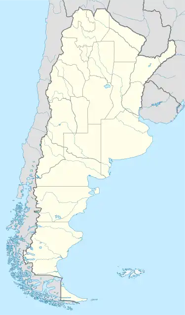
 San José de Jáchal Location of San José de Jáchal in Argentina | |
| Coordinates: 30°14′S 68°45′W / 30.233°S 68.750°W | |
| Country | |
| Province | |
| Department | Jáchal |
| Population (2001 census) | |
| • Total | 21,018 |
| Time zone | UTC-3 (ART) |
| CPA base | J5460 |
| Dialing code | +54 2647 |
San José de Jáchal (Spanish pronunciation: [saŋ xoˈse ðe ˈxatʃal], often shortened to Jáchal) is a city in the northeast of the province of San Juan, Argentina, located on National Route 40, south of the Jáchal River. It has 21,018 inhabitants per the 2001 census [INDEC], and is the head town of the Jáchal Department.
Climate
| Climate data for San José de Jáchal (1991–2020, extremes 1961–present) | |||||||||||||
|---|---|---|---|---|---|---|---|---|---|---|---|---|---|
| Month | Jan | Feb | Mar | Apr | May | Jun | Jul | Aug | Sep | Oct | Nov | Dec | Year |
| Record high °C (°F) | 42.7 (108.9) |
41.5 (106.7) |
39.6 (103.3) |
38.3 (100.9) |
36.2 (97.2) |
35.5 (95.9) |
35.5 (95.9) |
36.5 (97.7) |
39.1 (102.4) |
39.9 (103.8) |
43.0 (109.4) |
45.3 (113.5) |
45.3 (113.5) |
| Mean daily maximum °C (°F) | 32.9 (91.2) |
31.2 (88.2) |
29.0 (84.2) |
24.5 (76.1) |
20.5 (68.9) |
18.5 (65.3) |
17.6 (63.7) |
20.4 (68.7) |
22.8 (73.0) |
26.9 (80.4) |
30.3 (86.5) |
32.7 (90.9) |
25.6 (78.1) |
| Daily mean °C (°F) | 25.4 (77.7) |
23.3 (73.9) |
21.0 (69.8) |
16.0 (60.8) |
11.2 (52.2) |
8.4 (47.1) |
7.2 (45.0) |
10.0 (50.0) |
13.5 (56.3) |
18.3 (64.9) |
22.0 (71.6) |
24.9 (76.8) |
16.8 (62.2) |
| Mean daily minimum °C (°F) | 16.6 (61.9) |
15.1 (59.2) |
13.0 (55.4) |
7.2 (45.0) |
2.6 (36.7) |
−1.0 (30.2) |
−2.4 (27.7) |
−0.6 (30.9) |
3.3 (37.9) |
7.8 (46.0) |
11.8 (53.2) |
15.2 (59.4) |
7.4 (45.3) |
| Record low °C (°F) | 3.9 (39.0) |
3.5 (38.3) |
−1.2 (29.8) |
−3.3 (26.1) |
−8.1 (17.4) |
−11.0 (12.2) |
−12.4 (9.7) |
−11.3 (11.7) |
−7.4 (18.7) |
−5.6 (21.9) |
−3.8 (25.2) |
0.0 (32.0) |
−12.4 (9.7) |
| Average precipitation mm (inches) | 18.6 (0.73) |
32.3 (1.27) |
16.0 (0.63) |
8.2 (0.32) |
5.7 (0.22) |
3.2 (0.13) |
3.4 (0.13) |
1.8 (0.07) |
5.4 (0.21) |
4.8 (0.19) |
5.9 (0.23) |
18.1 (0.71) |
123.4 (4.86) |
| Average precipitation days (≥ 0.1 mm) | 4.5 | 4.8 | 3.7 | 2.6 | 2.0 | 1.2 | 1.2 | 1.3 | 1.5 | 1.5 | 1.2 | 2.9 | 28.5 |
| Average snowy days | 0.0 | 0.0 | 0.0 | 0.1 | 0.1 | 0.1 | 0.6 | 0.4 | 0.3 | 0.0 | 0.0 | 0.0 | 1.6 |
| Average relative humidity (%) | 53.4 | 58.1 | 62.0 | 64.9 | 66.2 | 63.4 | 61.7 | 56.0 | 54.4 | 50.6 | 48.2 | 49.1 | 57.3 |
| Mean monthly sunshine hours | 285.2 | 240.1 | 220.1 | 192.0 | 179.8 | 174.0 | 195.3 | 226.3 | 225.0 | 269.7 | 294.0 | 306.9 | 2,808.4 |
| Mean daily sunshine hours | 9.2 | 8.5 | 7.1 | 6.4 | 5.8 | 5.8 | 6.3 | 7.3 | 7.5 | 8.7 | 9.8 | 9.9 | 7.7 |
| Percent possible sunshine | 69 | 69 | 63 | 67 | 61 | 53 | 61 | 68 | 63 | 68 | 66 | 66 | 65 |
| Source 1: Servicio Meteorológico Nacional[1][2][3] | |||||||||||||
| Source 2: UNLP (percent sun 1971–1980)[4] | |||||||||||||
References
- ↑ "Estadísticas Climatológicas Normales - período 1991-2020" (in Spanish). Servicio Meteorológico Nacional. Retrieved 11 April 2023.
- ↑ "Estadísticas Climatológicas Normales – período 1991–2020" (PDF) (in Spanish). Servicio Meteorológico Nacional. 2023. Archived from the original on 8 July 2023. Retrieved 1 August 2023.
- ↑ "Clima en la Argentina: Guia Climática por Jachal". Caracterización: Estadísticas de largo plazo (in Spanish). Servicio Meteorológico Nacional. Retrieved 11 April 2023.
- ↑ "Datos bioclimáticos de 173 localidades argentinas". Atlas Bioclimáticos (in Spanish). Universidad Nacional de La Plata. Retrieved July 4, 2016.
- Municipal information: Municipal Affairs Federal Institute (IFAM), Municipal Affairs Secretariat, Ministry of Interior, Argentina. (in Spanish)
This article is issued from Wikipedia. The text is licensed under Creative Commons - Attribution - Sharealike. Additional terms may apply for the media files.