Sainte-Thérèse-de-Gaspé | |
|---|---|
 Fishing harbour in Sainte-Thérèse-de-Gaspé | |
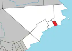
 Location within Le Rocher-Percé RCM. | |
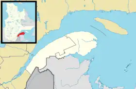
 Sainte-Thérèse-de-Gaspé Location in eastern Quebec. | |
| Coordinates: 48°25′N 64°25′W / 48.417°N 64.417°W[1] | |
| Country | |
| Province | |
| Region | Gaspésie–Îles-de-la-Madeleine |
| RCM | Le Rocher-Percé |
| Constituted | September 6, 1930 |
| Government | |
| • Mayor | Roberto Blondin |
| • Federal riding | Gaspésie—Îles-de-la-Madeleine |
| • Prov. riding | Gaspé |
| Area | |
| • Total | 34.60 km2 (13.36 sq mi) |
| • Land | 34.45 km2 (13.30 sq mi) |
| Population (2021)[4] | |
| • Total | 979 |
| • Density | 28.4/km2 (74/sq mi) |
| • Pop 2016-2021 | |
| • Dwellings | 504 |
| Time zone | UTC−5 (EST) |
| • Summer (DST) | UTC−4 (EDT) |
| Postal code(s) | |
| Area code(s) | 418 and 581 |
| Highways | |
Sainte-Thérèse-de-Gaspé is a municipality in the Gaspésie-Îles-de-la-Madeleine region of the province of Quebec in Canada. It is the smallest municipality, in land area and population, of the Le Rocher-Percé Regional County Municipality.
Fishing is its primary business, and its harbour handles the fourth highest value of seafood in Quebec. Its factories, employing hundreds of people, process snow crab, rock crab, and lobster.[5]
In addition to the village of Sainte-Thérèse-de-Gaspé itself, the municipality also includes the community of Saint-Isidore.
Demographics
Population
Canada census – Sainte-Thérèse-de-Gaspé community profile
| 2021 | 2011 | |
|---|---|---|
| Population | 979 (-3.5% from 2016) | 1,055 (-4.9% from 2006) |
| Land area | 34.45 km2 (13.30 sq mi) | 33.50 km2 (12.93 sq mi) |
| Population density | 28.4/km2 (74/sq mi) | 31.5/km2 (82/sq mi) |
| Median age | 56.4 (M: 55.6, F: 56.8) | 50.5 (M: 49.9, F: 51.1) |
| Private dwellings | 475 (total) | 470 (total) |
| Median household income | $36,496 |
|
|
|
Language
| Canada Census Mother Tongue - Sainte-Thérèse-de-Gaspé, Quebec[10] | ||||||||||||||||||
|---|---|---|---|---|---|---|---|---|---|---|---|---|---|---|---|---|---|---|
| Census | Total | French |
English |
French & English |
Other | |||||||||||||
| Year | Responses | Count | Trend | Pop % | Count | Trend | Pop % | Count | Trend | Pop % | Count | Trend | Pop % | |||||
2011 |
1,055 |
1,040 | 98.58% | 5 | 0.47% | 5 | 0.47% | 5 | 0.47% | |||||||||
2006 |
1,090 |
1,040 | 95.41% | 10 | 0.92% | 0 | 0.00% | 40 | 3.67% | |||||||||
2001 |
1,150 |
1,140 | 99.13% | 10 | 0.87% | 0 | 0.00% | 0 | 0.00% | |||||||||
1996 |
1,285 |
1,275 | n/a | 99.22% | 10 | n/a | 0.78% | 0 | n/a | 0.00% | 0 | n/a | 0.00% | |||||
See also
References
- ↑ "Banque de noms de lieux du Québec: Reference number 56436". toponymie.gouv.qc.ca (in French). Commission de toponymie du Québec.
- 1 2 "Sainte-Thérèse-de-Gaspé". Répertoire des municipalités (in French). Ministère des Affaires municipales, des Régions et de l'Occupation du territoire. Retrieved 2011-12-08.
- ↑ "Data table, Census Profile, 2021 Census of Population - Sainte-Thérèse-de-Gaspé, Municipalité (MÉ) [Census subdivision], Quebec". 9 February 2022.
- ↑ "Data table, Census Profile, 2021 Census of Population - Sainte-Thérèse-de-Gaspé, Municipalité (MÉ) [Census subdivision], Quebec". 9 February 2022.
- ↑ "Historique" (in French). Municipalité de Sainte-Thérèse-de-Gaspé. Retrieved 2011-12-08.
- ↑ "2021 Community Profiles". 2021 Canadian Census. Statistics Canada. February 4, 2022. Retrieved 2022-04-27.
- ↑ "2011 Community Profiles". 2011 Canadian Census. Statistics Canada. March 21, 2019. Retrieved 2014-01-30.
- ↑ "2006 Community Profiles". 2006 Canadian Census. Statistics Canada. August 20, 2019.
- ↑ "2001 Community Profiles". 2001 Canadian Census. Statistics Canada. July 18, 2021.
- 1 2 Statistics Canada: 1996, 2001, 2006, 2011, 2016, 2021 census
This article is issued from Wikipedia. The text is licensed under Creative Commons - Attribution - Sharealike. Additional terms may apply for the media files.