Sainte-Hélène-de-Bagot | |
|---|---|
 | |
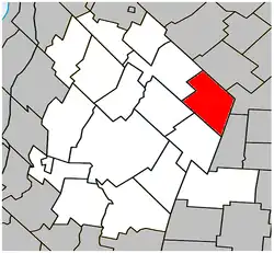
 Location within Les Maskoutains RCM. | |
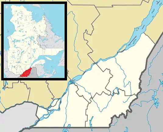
 Sainte-Hélène-de-Bagot Location in southern Quebec. | |
| Coordinates: 45°44′N 72°44′W / 45.733°N 72.733°W[1] | |
| Country | |
| Province | |
| Region | Montérégie |
| RCM | Les Maskoutains |
| Constituted | July 9, 1977 |
| Government | |
| • Mayor | Yves Petit |
| • Federal riding | Saint-Hyacinthe—Bagot |
| • Prov. riding | Johnson |
| Area | |
| • Total | 71.40 km2 (27.57 sq mi) |
| • Land | 73.42 km2 (28.35 sq mi) |
| There is an apparent contradiction between two authoritative sources | |
| Population (2011)[4] | |
| • Total | 1,637 |
| • Density | 22.3/km2 (58/sq mi) |
| • Pop 2006-2011 | |
| • Dwellings | 701 |
| Time zone | UTC−5 (EST) |
| • Summer (DST) | UTC−4 (EDT) |
| Postal code(s) | |
| Area code(s) | 450 and 579 |
| Website | www.sainte helenedebagot.com |
Sainte-Hélène-de-Bagot is a municipality in southwestern Quebec, Canada in the Regional County Municipality of Les Maskoutains. The population as of the Canada 2011 Census was 1,637.
-Panneau_d'accueil-rue_Principale_(pr%C3%A8s_de_l'autoroute_20)-2022-07-18.jpg.webp)
History
This municipality was born from the merger, in 1977, of the parish municipality of Sainte-Hélène, founded in 1855, and the village municipality of Sainte-Hélène-de-Bagot, founded in 1925.[5]
Geography
Sainte-Hélène-de-Bagot is located between Saint-Hyacinthe and Drummondville and is crossed by the Highway 20 - Jean-Lesage, the village on one side and the land on the other.
Its location allowed, in the 1970s, with the construction of a highway between Montreal and Quebec, to become a stopover village.[6] Several restaurants and service stations are present in this locality of 1500 inhabitants. According to the Ministry of Transport of Quebec, more than 1000 trucks a day stop in this small village.
The municipality was once part of County of Bagot. It is now part of the provincial riding of Johnson.[7]
Demographics
Population
| 2021 | 2011 | |
|---|---|---|
| Population | 1,696 (+0.5% from 2016) | 1,637 (+13.2% from 2006) |
| Land area | 72.41 km2 (27.96 sq mi) | 73.42 km2 (28.35 sq mi) |
| Population density | 23.4/km2 (61/sq mi) | 22.3/km2 (58/sq mi) |
| Median age | 39.2 (M: 38.8, F: 39.6) | 36.0 (M: 36.6, F: 34.7) |
| Private dwellings | 715 (total) | 701 (total) |
| Median household income | $55,586 |
|
|
|
Language
| Canada Census Mother Tongue - Sainte-Hélène-de-Bagot, Quebec[11] | ||||||||||||||||||
|---|---|---|---|---|---|---|---|---|---|---|---|---|---|---|---|---|---|---|
| Census | Total | French |
English |
French & English |
Other | |||||||||||||
| Year | Responses | Count | Trend | Pop % | Count | Trend | Pop % | Count | Trend | Pop % | Count | Trend | Pop % | |||||
2011 |
1,630 |
1,600 | 98.16% | 10 | 0.61% | 5 | 0.31% | 15 | 0.92% | |||||||||
2006 |
1,440 |
1,385 | 96.18% | 0 | 0.00% | 0 | 0.00% | 55 | 3.82% | |||||||||
2001 |
1,505 |
1,475 | 98.01% | 0 | 0.00% | 0 | 0.00% | 30 | 1.99% | |||||||||
1996 |
1,470 |
1,470 | n/a | 100.00% | 0 | n/a | 0.00% | 0 | n/a | 0.00% | 0 | n/a | 0.00% | |||||
See also
References
- ↑ "Banque de noms de lieux du Québec: Reference number 76207". toponymie.gouv.qc.ca (in French). Commission de toponymie du Québec.
- 1 2 Ministère des Affaires municipales, des Régions et de l'Occupation du territoire: Sainte-Hélène-de-Bagot
- ↑ Parliament of Canada Federal Riding History: SAINT-HYACINTHE--BAGOT (Quebec)
- 1 2 3 "2011 Community Profiles". 2011 Canadian Census. Statistics Canada. March 21, 2019. Retrieved 2014-03-23.
- ↑ Toponymy: Sainte-Hélène-de-Bagot
- ↑ ToposWeb/fiche.aspx?no_seq=291247 Rest area
- ↑ "Individual maps of the 125 electoral districts 2017". Élections Québec (in French). Retrieved 2020-01-29.
- ↑ "2021 Community Profiles". 2021 Canadian Census. Statistics Canada. February 4, 2022. Retrieved 2022-04-27.
- ↑ "2006 Community Profiles". 2006 Canadian Census. Statistics Canada. August 20, 2019.
- ↑ "2001 Community Profiles". 2001 Canadian Census. Statistics Canada. July 18, 2021.
- 1 2 Statistics Canada: 1996, 2001, 2006, 2011 census