Rozvadov | |
|---|---|
 Rozvadov / Waidhaus border crossing | |
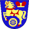
 Flag  Coat of arms | |
 Rozvadov Location in the Czech Republic | |
| Coordinates: 49°40′6″N 12°33′7″E / 49.66833°N 12.55194°E | |
| Country | |
| Region | Plzeň |
| District | Tachov |
| First mentioned | 1581 |
| Area | |
| • Total | 54.94 km2 (21.21 sq mi) |
| Elevation | 570 m (1,870 ft) |
| Population (2023-01-01)[1] | |
| • Total | 797 |
| • Density | 15/km2 (38/sq mi) |
| Time zone | UTC+1 (CET) |
| • Summer (DST) | UTC+2 (CEST) |
| Postal code | 348 07 |
| Website | www |
Rozvadov (German: Roßhaupt) is a municipality and village in Tachov District in the Plzeň Region of the Czech Republic. It has about 800 inhabitants. Located on the Czech-German border, the municipality is known for one of the busiest road border crossings in the country. Rozvadov is also known for King's Casino Rozvadov, one of the largest casinos in Central Europe.
Administrative parts

The villages of Diana, Milíře, Nové Domky, Rozcestí and Svatá Kateřina are administrative parts of Rozvadov.
Etymology
The name is derived from the personal name Rozvad, meaning "Rozvad's (court)".[2]
Geography
Rozvadov is located about 15 kilometres (9 mi) southwest of Tachov, 59 km (37 mi) west of Plzeň, on the border with Germany. It lies in the central part of the Upper Palatine Forest. The highest point of the municipality is below the summit of the hill Javorný vrch, at 674 metres (2,211 ft).
History
The first written mention of Rozvadov is from 1581. The customs office is first mentioned in 1613. The current customhouse is a building from 1934.[3]
Before the expulsion of Germans in the wake of World War II, the municipality had a German-speaking majority.
Demographics
|
|
| ||||||||||||||||||||||||||||||||||||||||||||||||||||||
| Source: Censuses[4][5] | ||||||||||||||||||||||||||||||||||||||||||||||||||||||||
Economy
King's Casino Rozvadov is located here and as of 2021, it contains the largest poker room in Europe.[6]
Transport
Rozvadov is known for its important road border crossing with Germany Rozvadov / Waidhaus, located on the D5 motorway.
Sights

The most valuable monument is the Church of Saint Catherine in Svatá Kateřina. It was built in the Baroque style in the first half of the 18th century, on the site of a Gothic provostship with the chapel of the Virgin Mary.[7]
The Church of the Visitation of the Virgin Mary is located in Nové Domky. It is a rare example of a church built purely in the Empire style. It dates from 1836. The building is dilapidated and unused, but is gradually repaired.[8]
The village of Diana is known for Diana Castle. It is a Baroque hunting lodge built before 1732 and modified in the Neoclassical style. It was built for the Kolowrat family and named after Diana, the goddess of hunters. Next to the castle is a park. Today the building is privately owned and unused.[9]
References
- ↑ "Population of Municipalities – 1 January 2023". Czech Statistical Office. 2023-05-23.
- ↑ Profous, Antonín (1951). Místní jména v Čechách III: M–Ř (in Czech). p. 603.
- ↑ "Historie" (in Czech). Obec Rozvadov. Retrieved 2021-06-14.
- ↑ "Historický lexikon obcí České republiky 1869–2011 – Okres Tachov" (in Czech). Czech Statistical Office. 2015-12-21. pp. 13–14.
- ↑ "Population Census 2021: Population by sex". Public Database. Czech Statistical Office. 2021-03-27.
- ↑ Glatzer, Jason (2018-10-01). "History of the WSOP Europe Part I: The London Years". PokerNews. Retrieved 2018-12-29.
- ↑ "Kostel sv. Kateřiny" (in Czech). National Heritage Institute. Retrieved 2023-11-16.
- ↑ "Kostel sv. Navštívení Panny Marie" (in Czech). National Heritage Institute. Retrieved 2023-11-16.
- ↑ "Zámek Diana" (in Czech). National Heritage Institute. Retrieved 2023-11-16.